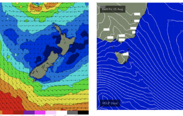
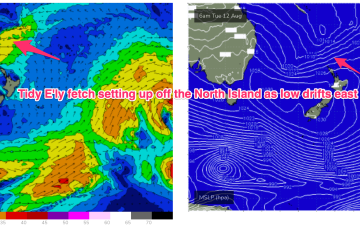
These low centres are focussing areas of E’ly to NE’ly infeed along the trough line- perfectly aimed at east coast targets all the way down to Tasmania.
Primary tabs
/reports/forecaster-notes/eastern-tasmania/2025/08/25/plenty-ene-ne-swell-short-term-gusty-wly-winds
freeride76
Monday, 25 August 2025
/reports/forecaster-notes/eastern-tasmania/2025/08/22/quality-the-ne-s-swells-next-weekend
freeride76
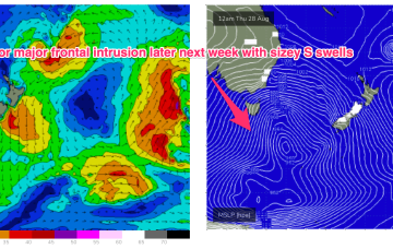
Friday, 22 August 2025
Surf-wise, whatever configuration of low pressure we end up getting, a broad E’ly infeed in the Southern Coral Sea and Northern Tasman as well as one off the South Coast aimed at Tasmania will generate plenty of E/NE’ly swell into early-mid week.
/reports/forecaster-notes/eastern-tasmania/2025/08/20/swells-the-ne-ahead-winter-returns-late-next
freeride76
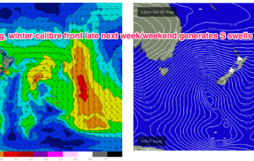
Wednesday, 20 August 2025
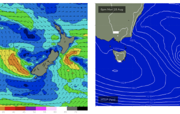
We’ll see the NE’ly flow continue to develop in the Northern Tasman and Coral Seas through this week, with swells from that E-NE quadrant building through this short term period under an onshore flow.
/reports/forecaster-notes/eastern-tasmania/2025/08/18/small-start-building-ne-swells-thurs
freeride76
Monday, 18 August 2025
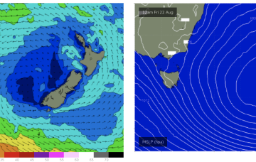
The dominant player is a massive high moving through the Bight and expected to drift over and eastwards of Tasmania tomorrow to occupy the Tasman for most of the week.
/reports/forecaster-notes/eastern-tasmania/2025/08/15/small-blend-over-the-weekend-s-swells-early
freeride76
Friday, 15 August 2025
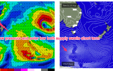
We may see a deepening trough and E/NE-NE infeed dip south later next week bringing some sizey E/NE-NE swell to Tas next weekend.
/reports/forecaster-notes/eastern-tasmania/2025/08/13/small-surf-around-the-compass-ahead
freeride76
Wednesday, 13 August 2025
SE-E/SE swell is the main swell next week as the low remains slow moving in the eastern Tasman.
/reports/forecaster-notes/eastern-tasmania/2025/08/11/small-week-ne-windswell-fri-and-strong-s-swell
freeride76
Monday, 11 August 2025
The weekend’s fronts and lows sweeping up from the south look to consolidate early next week into a much stronger system, backed by a strong high in the Bight.
/reports/forecaster-notes/eastern-tasmania/2025/08/08/east-swell-comes-close
Craig
Friday, 8 August 2025
The great run of east swell finally comes to a close over the weekend.
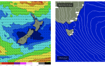
/reports/forecaster-notes/eastern-tasmania/2025/08/06/easing-ene-swells-the-weekend-offshore-winds
freeride76
Wednesday, 6 August 2025
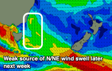
We should see some better quality, albeit small E/NE swell later next week from a new sub-tropical low which forms this weekend and then drifts out towards the North Island.
/reports/forecaster-notes/eastern-tasmania/2025/08/04/plenty-quality-ene-swell-slow-easing-through
freeride76
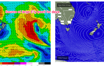
Monday, 4 August 2025
This slow moving fetch will maintain elevated E/NE’ly swells for the majority of this week with embedded pulses and only a very slow easing trend through the week.