Downgraded E swell still offers some fun moments short term
Monday, 21 July 2025
Downgraded E swell still offers some fun moments short term
Monday, 21 July 2025
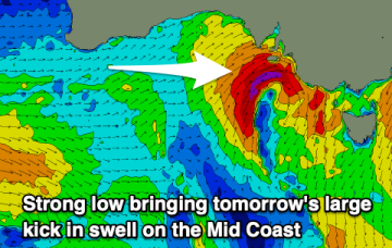
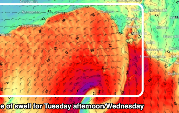
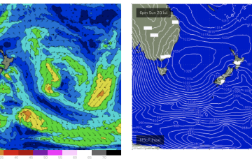
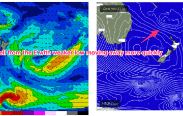
Unfortunately, compared to Fridays expectations the interplay between these two systems is weaker, with a more constrained fetch of lower windspeeds that drifts away quicker than modelled on Friday. That will result in smaller east quadrant swell this week, relative to Fridays expectations.