More large surf to come

South Australian Forecast by Craig Brokensha (issued Friday July 18th)
Best Days: Today South Coast, tomorrow South Coast, both coasts Sunday, South Coast most of next week
Features of the Forecast (tl;dr)
- Large reinforcing W/SW groundswell for tomorrow, with a secondary mid-period swell for Sun, easing
- Strong N/NW tending W/NW winds tomorrow.
- Early variable tending N/NE then N/NW on the Mid Sun (without much strength), light-mod N/NW winds all day down South
- Easing surf Mon with strengthening N/NE winds
- Large W/SW groundswell building later on the Mid Tue with strong NW winds
- Swell peakined Wed down South with mod-fresh NW winds
- Easing swell Thu with N/NE winds
Recap
The Mid Coast provided plenty of surf through yesterday and early, fresh onshore winds became lighter for a period offering lumpy waves before deteriorating again into the afternoon.
The South Coast offered good waves in protected spots with plenty of size to 4-5ft off Middleton, easing a little into the afternoon.
Today our larger W/SW groundswell is peaking with great offshore winds down South and surf to 4-6ft off Middleton, 2ft to occasionally 3ft across the Mid Coast with workable N/NE winds.
Winds will freshen from the N/NW into this afternoon, adding increasing bumps and chops on the Mid Coast while keeping the South Coast clean.
This weekend and next week (Jul 19 - 25)
Two swell pulses down, one to go.
Yesterday and today have seen the first two large groundswells filling in, and we’ve got a final reinforcing pulse, due tomorrow, generated by a final fetch of severe-gale W/NW winds moving in on the active sea state generated by storm linked to today’s swell.
The Mid Coast looks to hold the 2ft to occasionally 3ft range with Middleton coming in at 4-5ft+, and strong N/NW tending W/NW winds will favour the South Coast.
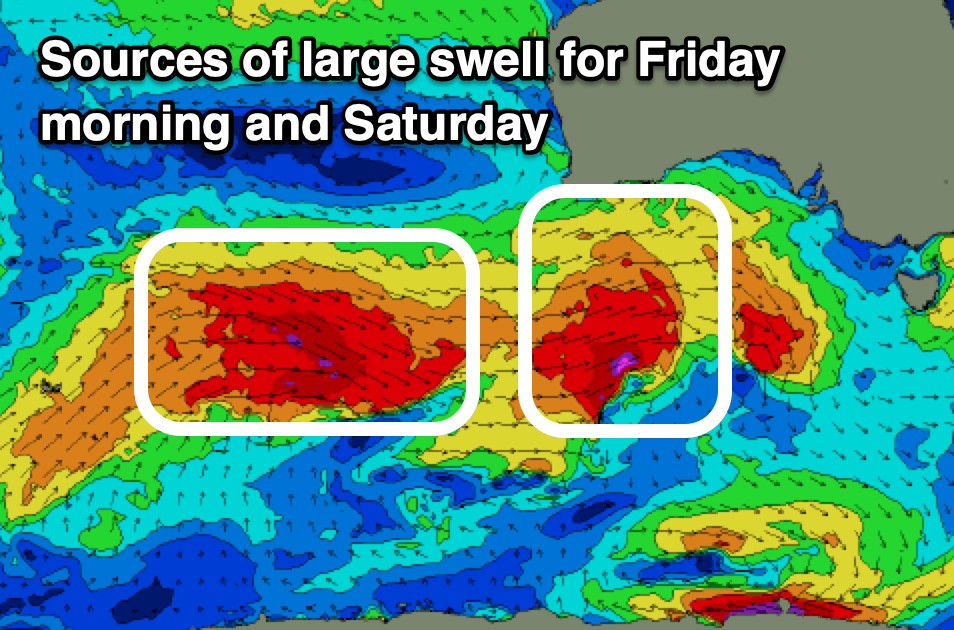
Later in the day but more so Sunday, an additional mid-period W/SW swell is expected across the Mid Coast, generated by the remnants of the storm linked to Saturday’s swell pushing in and across us.
This will maintain 2-3ft waves on the Mid as the South Coast eases back from 3-5ft across Middleton.
Looking at the local winds for Sunday and variable offshore winds are due to quickly shift N/NE through the morning on the Mid Coast, weak N/NW into the afternoon creating decent conditions most of the day. The South Coast will be great under the light to moderate N/NW flow.
Easing surf is then due into early next week with the South Coast being the pick as N/NE winds strengthen on Monday, shifting NW into Tuesday.
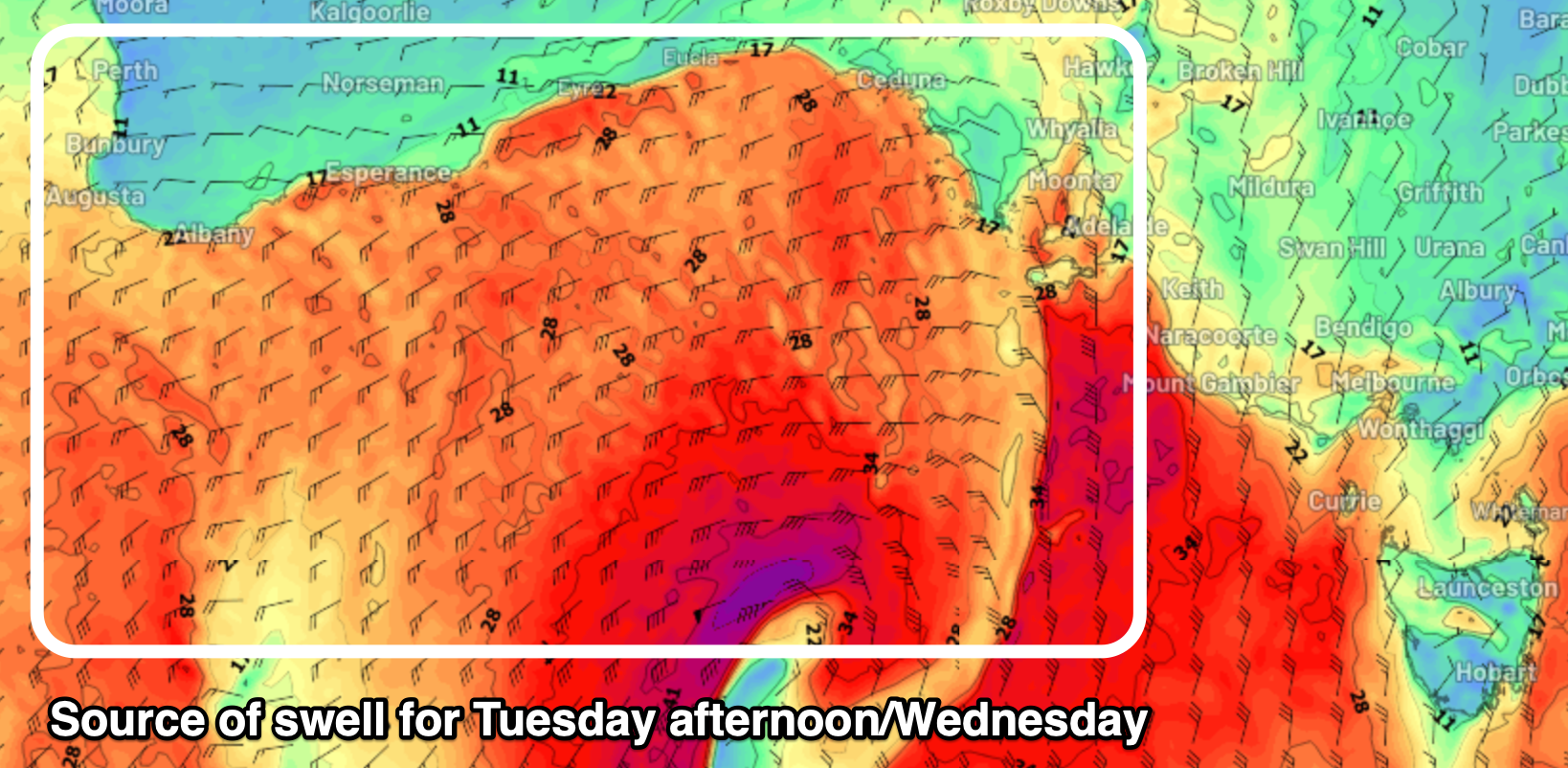
This will be thanks to a strong, deepening mid-latitude low in the Bight, with it expected to direct a tight fetch of gale to severe-gale W/SW winds through our western swell window on Tuesday.
With this, a large pulse of W/SW groundswell is likely later Tuesday afternoon on the Mid Coast to 3-4ft (we’ll review this Monday), but with choppy conditions, with the South Coast only kicking later, peaking Wednesday morning to 3-4ft under persistent NW winds.
As the swell eases Thursday, it looks like N/NE winds will favour the exposed beaches down South with the next run of swell likely to kick in from next weekend. Have a great weekend!