Improving options on the beaches from Sunday
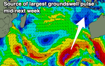
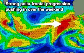
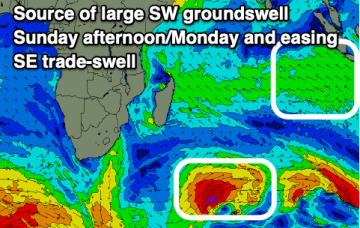
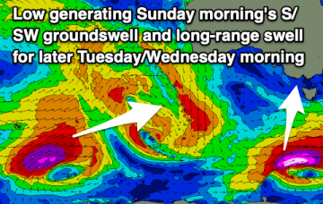
The wind will remain a little funky though workable tomorrow, much better from Sunday. Increasing westerly swells are due through next week/weekend.
A deep, complex low pressure system (see Beast from the East) then forms in the Tasman and slowly migrates towards the North Island with large E’ly swell pulses generated over a prolonged period.
That will lead to elevated surf from the SE-E for most of next week with just a very slow, gradual tapering off as the fetch slowly weakens while remaining basically semi-stationary.
We've got building swell energy with favourable winds.
Make the most of the favourable winds before oversized, stormy surf kicks in from the weekend.
E’ly gales in a broad fetch remain into the new week with a massive high new New Zealand (1042hPa) acting as supporting cradle for the Tasman low which will be drifting eastwards to a slot north of the North Island.
Conditions are expected to be mostly lumpy to end the week, improving slowly over the weekend. Next week looks large out of the west.
Winds will mostly spoil the surf over the coming days, improving from Sunday. Next week looks interesting from Wednesday.
Upgrade in swell for tomorrow, large pulses next week.