Cleanest today and early tomorrow

Western Australian Forecast by Craig Brokensha (issued Wednesday July 30th)
Best Days: Today, selected spots tomorrow, Wednesday next week in metro locations, Thursday all locations
Features of the Forecast (tl;dr)
- Large SW groundswell for this afternoon with weak N/NW winds, with a slightly smaller, reinforcing SW groundswell tomorrow
- NE tending strong N/NE winds in the South West tomorrow, E/NE tending N/NW to the north
- Easing surf Fri with strong N/NE tending N winds
- Large windswell building Sat with strong N/NW tending W winds
- XL mix of swells Sun with strong to gale-force W winds
- Easing surf Mon with strong W/SW winds
- A touch smaller Tue with strong SW winds
- XL SW groundswell for later Tue, easing Wed with SW winds (likely E/NE to the north)
Recap
Conditions were still quite raw and wind affected through yesterday with plenty of size still coming in at 2-3ft across Perth, 3ft+ Mandurah and 8ft or so in the South West.
This morning conditions have cleaned up as expected but the swell is on the decline in both size and energy. Most locations have a fun wave for a morning paddle and a new SW groundswell is expected to start showing soon, reaching 6-8ft into the afternoon as winds tend light N/NW.
This week and next (Jul 31 - Aug 8)
This afternoon’s increase in SW groundswell is expected to be backed up by a reinforcing pulse of energy tomorrow, generated by a less favourably aimed fetch of severe-gale W/NW-NW winds tracking south-east, at right angles to our swell window.
With this a touch less size to 6ft+ is due in the South West with slower 2ft sets to the north and winds will be doable early out of the NE (E/NE metro regions) before strengthening out of the N/NE in the South West, shifting N/NW to the north. This should favour selected breaks in the South West most of the day ahead of poor surf Friday with a drop in swell and strengthening N/NE tending N winds.
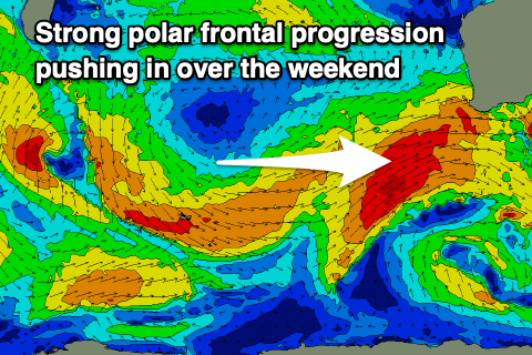
As we move into the weekend we’re set to see a strong progression of frontal systems pushing up and into us, bringing a mix of stormy, localised windswell and building groundswell energy.
Saturday will consist of mostly low period windswell with strong N/NW tending W’ly winds, with a large groundswell expected into Sunday mixed in with some larger windswell as local winds reach near gale-force.
These stronger winds will be associated with a significant polar front pushing up and into us, bringing surf to a stormy 15ft+ in the South West and sizey waves on the metro beaches.
Winds are expected to back off in between frontal systems on Monday as the swell also eases, though remaining fresh to strong onshore, shifting more SW on Tuesday.
An even stronger polar frontal progression looks to push up and into us early next week, bringing with it another XL pulse of SW groundswell for later Tuesday, easing Wednesday as strong SW winds persist in the South West, cleaner and better to the north under variable offshores.
At this stage Mandurah looks to come in at 4-5ft+ with 3-4ft sets in Perth but we’ll review this Friday.
The frontal activity looks to settle through the middle to end of next week as high pressure slowly moves in from the west, bringing easing surf with cleaner conditions. More on this Friday.