Flukey outlook this week
Monday, 28 July 2025
Flukey outlook this week
Monday, 28 July 2025
The coming week would be better spent in the snow than surf.
The coming week would be better spent in the snow than surf.
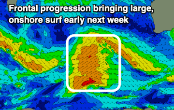
Besides early tomorrow the weekend looks average with deteriorating winds. Large surf is due early next week but with strong winds.
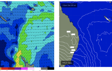
High pressure has drifted up over NENSW and into the Tasman and an approaching trough and cut-off low really ramps up the pressure gradient short term, leading to fresh/strong N/NE-N’ly winds off the coast.
Inshore we’ll see those winds between 10-15 kts through the morning tending stronger N’ly through the day and generating small NE windswells for the MNC up to Yamba, not much further north of there.
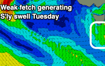
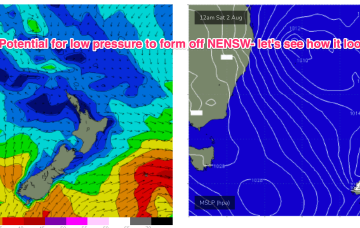
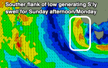
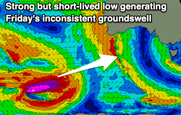
Low pressure formation looks likely, possibly a strong cut-off low moving into the Tasman Thurs and offering an initial spike in S swell Thurs before better angled S/SE swell into the weekend if the low hangs around in the south-east Tasman near the South Island.
The coming period isn't that productive surf wise with a poor weekend, best early next week.
Today and tomorrow are the pick of the period for the exposed beaches with nothing really of note for the Surf Coast.
The next two swells will come in smaller than model outlooks.
Nothing of interest in the Coral Sea next week suggesting more tiny/flat surf.