Remaining tiny/flat as high pressure remains at sub-tropical latitudes
Monday, 21 July 2025
Remaining tiny/flat as high pressure remains at sub-tropical latitudes
Monday, 21 July 2025
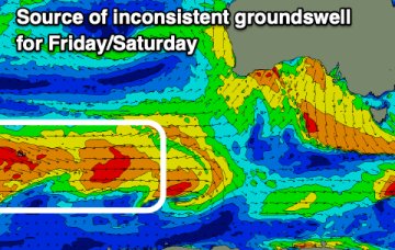
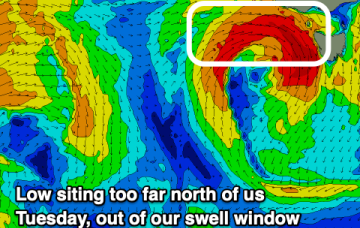
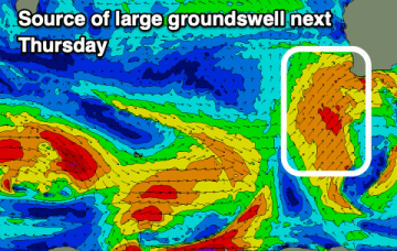
Tiny surf continues this week as high pressure remains in the Tasman with a low not quite in the swell window and swells too weak to get around K’gari (Fraser Is).