Make the most of today and tomorrow

Victorian Forecast by Craig Brokensha (issued Friday July 25th)
Best Days: Exposed beaches today and tomorrow
Features of the Forecast (tl;dr)
- Inconsistent mix of SW groundswell and mid-period W/SW swell this afternoon and tomorrow, easing Sun
- Strong N/NE winds tomorrow, freshening W/NW Sun
- Small, weak W/SW-SW swell building Mon PM, easing Tue
- Strong W/NW tending slightly weaker W/SW winds Mon
- Inconsistent SW groundswell for Mon PM and Tue AM
- NW winds Tue
- S winds Wed through Fri with small surf
- Inconsistent, moderate sized W/SW groundswell likely for later Fri, peaking Sat with N winds
Recap
Wednesday afternoon’s kick in W/SW swell held well into yesterday morning, coming in at a clean, peaky 2-3ft across semi-protected spots on the Surf Coast all day, bumpy/lumpy and average to the east.
This morning we’ve got less size with better winds for the exposed beaches and fun surf due most of the day.

Nice sinrise and good potential today
This weekend and next week (Jul 26 - Aug 1)
As talked about through the week, an inconsistent mix of long-range SW groundswell and mid-period W/SW swell are due to build through today, holding tomorrow before easing Sunday.
While not overly sizey, the exposed beaches will do well with the Surf Coast expected to peak around 2ft+ with 4ft+ sets to the east. Winds will shift more NE into this afternoon with tomorrow seeing strong N/NE winds most of the day, possibly tending a little more N’th through the middle of it.
Into Sunday, winds are due to shift to the W/NW and freshen as a slow moving mid-latitude low edges in from the west, but size wise the Surf Coast will be small and fading.
This low still isn’t expected to bring much in the way of swell, with a weak fetch of strong W/SW-SW winds due to move through Bass Strait on Monday, bringing with it a localised increase in size.
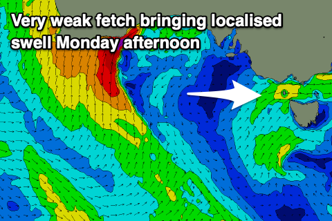
The Surf Coast might see sets reaching 2-3ft into the afternoon but with winds shifting W/SW after a strong, morning W/NW breeze with no size.
Tuesday looks better with a W/NW-NW tending variable breeze and some inconsistent, long-range groundswell that should build slowly through Monday.
The source was a strong polar frontal progression that fired up around the Heard Island region earlier this week and with this the Surf Coast only looks to come in at a slow 2ft+ with 4ft sets to the east.
Otherwise the outlook remains slow with nothing of note until later in the week, when a stream of south-east dipping storms from the south of Western Australia bringing small to moderate levels of groundswell.
Unfortunately troughy weather will bring S’ly winds mid-late week, likely improving next weekend when the most size is due, but more on this Monday. Have a great weekend!