Good S/SE pulse tomorrow
Wednesday, 11 June 2025
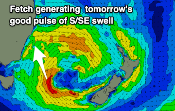
Good S/SE pulse tomorrow
Wednesday, 11 June 2025
We've got a better angled pulse of S/SE energy for tomorrow with decent winds through the morning.
We've got a better angled pulse of S/SE energy for tomorrow with decent winds through the morning.
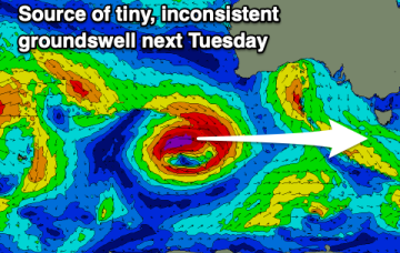
We've got a tiny run of surf following the current mix of swells.
The coming period is tricky wind wise with the constant progression of frontal systems. Today in metro regions looks like capitalising on.
The Mid Coast will be sizey and mostly clean over the coming days with the South Coast providing good conditions right through until next week and beyond.
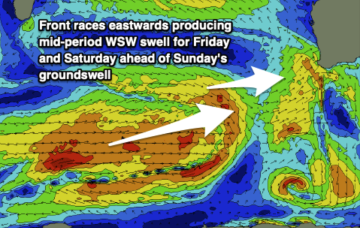
The coming period looks great and active for the Surf Coast with increasing westerly swell energy. Locations to the east will improve from Friday through the weekend.
A few incoming WSW pulses with clean days up north, but mostly blown out down south.
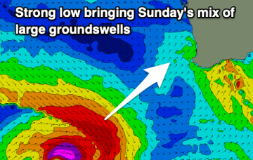
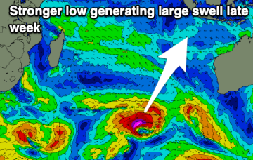
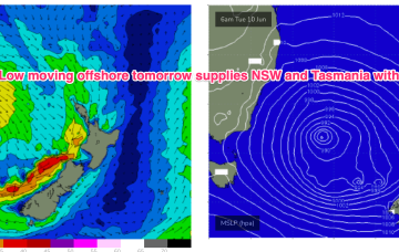
We’ll see the low move slowly out to sea later tomorrow with large stormy swells for East Tas slowly easing and improving in quality.
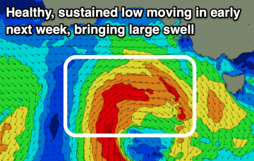
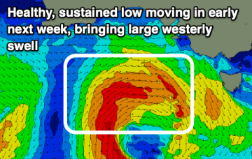
We’ll see the low move slowly out to sea later tomorrow and generate an initial pulse of local, directional S swell before moving further into the Tasman with better angled swells produced for later in the week.
We’ll see the low move slowly out to sea later tomorrow and generate an initial pulse of local, directional S swell before moving further into the Tasman with better angled swells produced for later in the week.