Make the most of the coming days

Southern Tasmanian Forecast by Craig Brokensha (issued Wednesday May 11th)
Best Days: Today, tomorrow
Features of the Forecast (tl;dr)
- Easing mix of E/SE and SW swells tomorrow, smaller Fri
- N/NW tending variable winds tomorrow and Fri
- Tiny W'ly swell Fri, fading on the weekend
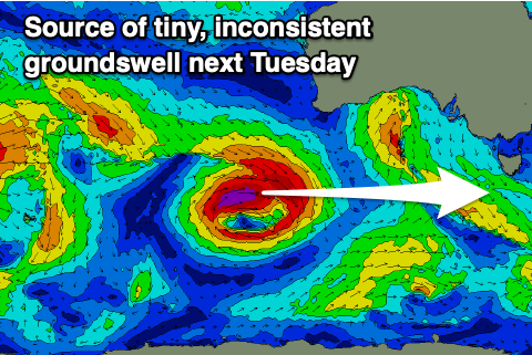
- Tiny W'ly swell later Mon and Tue
Recap
Conditions were poor through yesterday with developing onshore winds and a junky mix of swells, but this morning we’ve got cleaner conditions and fun 2-3ft sets from the SE across Clifton. There’s also an inconsistent SW groundswell in the mix.
This week and next (Jun 12 - 20)
The current mix of mid-period E/SE swell and SE windswell are due to start easing through tomorrow, but it will be a slow decline thanks to the low linked to it, sitting just east of us still generating some decent energy this morning.
Clifton should ease from 2ft to occasionally 3ft tomorrow morning, smaller into Friday and easing from 1-2ft. Exposed breaks further down Storm Bay should see more size out of this easterly swell energy.
Local winds tomorrow look great and N/NW tending variable with similar breezes Friday.
A long-period W/SW groundswell showing for later tomorrow and Friday has no size to it, with it being generated north of our swell window by a strong low that was west-southwest of Western Australia.
Sunday/Monday also look to remain tiny, while another long-period W’ly groundswell for Tuesday also looks less than ideal. The low linked to this will form south-west of Western Australia Thursday evening/Friday, generating a fetch of W’ly gales in our far western swell window.
The swell is due later Monday, peaking Tuesday but sets aren’t likely to top 1-1.5ft.
Longer term the outlook is a little more promising from next weekend if not more so the following week. More on this Friday.