Severe Tropical Cyclone Sean adds some flukey north swell to the mix
Monday, 20 January 2025
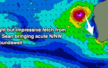
Severe Tropical Cyclone Sean adds some flukey north swell to the mix
Monday, 20 January 2025
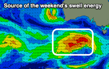
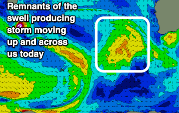
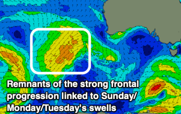
The coming week is mostly average, apart from a flukey northerly groundswell from Severe Tropical Cyclone Sean.