Large southerly swells inbound
Monday, 13 January 2025

Large southerly swells inbound
Monday, 13 January 2025
We've got a large, windy outlook from Friday through the weekend.
We've got a large, windy outlook from Friday through the weekend.
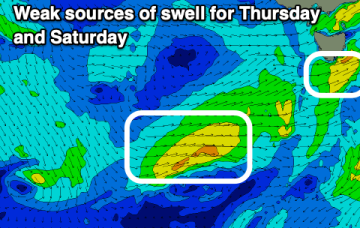
The coming period isn't great at all with better options to the east.
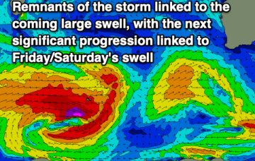
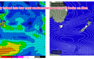
Main features on the synoptics this week are an approaching front from the west, a strong high just west of New Zealand and a deepening surface trough in the northern Tasman Sea - the latter of which will feed additional moisture into an already-evolving dynamic setup.
We've got two large swells on the way, cleanest as they ease. Make the most of it before things go a little quiet.
The Mid Coast will continue to provide good waves this period.
The coming period isn't great wind wise though there are a couple of groundswells inbound.
There’s no sign of any Tradewinds into and through next week with tiny/flat surf expected right into next weekend.
This would see a new E’ly-E/NE’ly swell fill in Fri and reach large levels over the weekend with an E’ly fetch aimed straight at Tasmania.
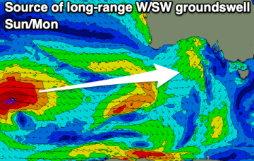
Apart from Sunday morning, onshore winds will spoil a small pulse of W/SW swell.
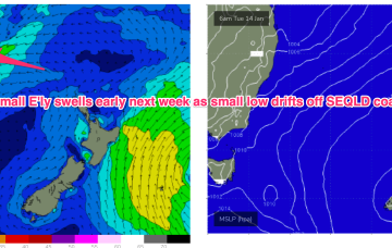
During this time, models are suggesting a small trough of low pressure will bud off the inland low and drift into the Coral Sea off the SEQLD Coast, which enhances the SE flow through SEQLD, extending down into NENSW by Tues, although winds will remain E/NE-NE south of Coffs.