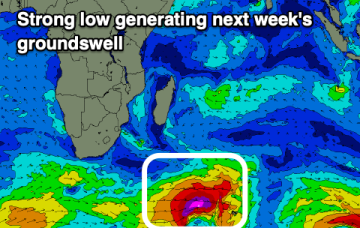
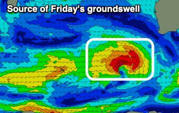
Make the most of whats on offer in the short run as our weak summer continues
Wednesday, 8 January 2025
Make the most of whats on offer in the short run as our weak summer continues
Wednesday, 8 January 2025
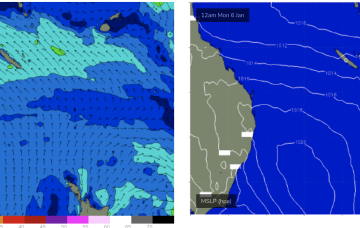
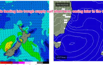
A small trough of low pressure has stalled off Seal Rocks with a SE infeed south of the trough expected to ease over the next 24 hrs and a light/variable flow north of the trough.