Workable but weak with the first significant swell of the year proving elusive
Monday, 6 January 2025
Workable but weak with the first significant swell of the year proving elusive
Monday, 6 January 2025
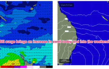
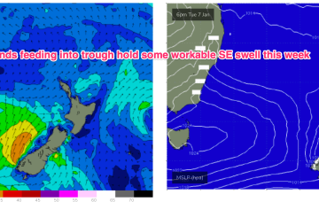
The current synoptic situation has a Groundhog Day feel to it, with another very weak high pressure cell in the Tasman (1019hPa), directing a mod N’ly flow along the temperate NSW coastline, with a weak Tradewind flow in the Coral Sea