Workable winds for the coming period with fun swells
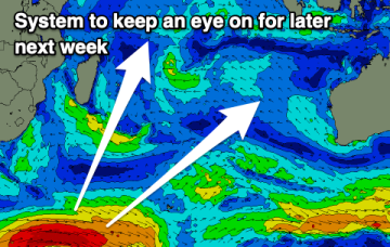
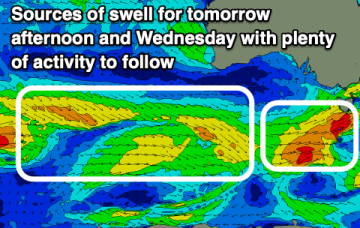
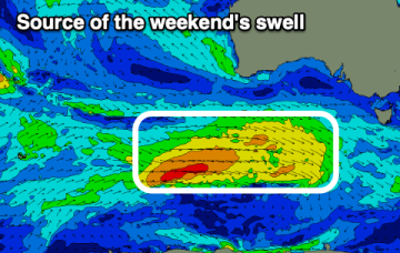
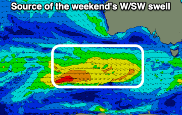
The end of the week looks a bit better wind wise, clean and fun from the weekend.
Slow week ahead with some new swell for late next week.
Model runs have been all over the place next week as they struggle to resolve an active monsoon trough which extends out from Northern Australia across the Coral Sea and into the South Pacific Island chains.
NETas is likely to see at least some workable NE windswell during this period and possibly some E/NE swell of tropical origins.
The coming week is a bit more miss than hit thanks to less than favourable winds at the peak of swell.
Multiple low pressure systems are suggested on long range model guidance, potentially tropical cyclones which could deliver large E’ly swells.
Once the change hits today, it'll be all over until the weekend.
Longer term is starting to look more dynamic as the tropics finally starts to fire up. Multiple low pressure systems are suggested on long range model guidance, potentially tropical cyclones.
An early evening change today will be followed by poor winds right through until the coming weekend.