Upgrade for next week as trade-winds rebuild
Friday, 7 February 2025
Upgrade for next week as trade-winds rebuild
Friday, 7 February 2025
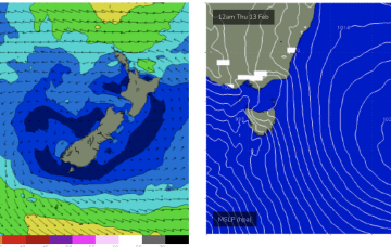
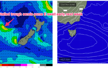
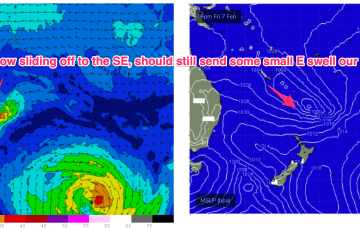
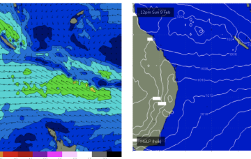
Surfwise E’ly swells from trade-winds off the top of the high will hold show more energy Mon, up a notch through Tues as the general wind field in the Southern Coral re-strengthens and more mid period swells make landfall from the stalled progression of lows in the South Pacific.