Strong swell to end the week
Monday, 26 May 2025
Strong swell to end the week
Monday, 26 May 2025
The coming days look poor ahead of a solid swell later week.
The coming days look poor ahead of a solid swell later week.
Today is the pick of the period surf wise across all locations.
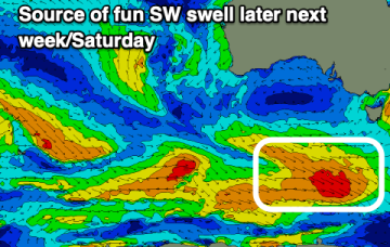
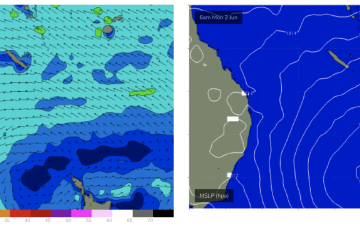
The mid-latitude low is moving in from the west while weakening, with easing winds and swell over the coming days. The weekend looks great for the South Coast.
The late increase in swell due today is now expected overnight with tomorrow revealing the best surf.
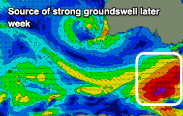
Today's strong swell will fade into the weekend ahead of stormy surf mid-next week.
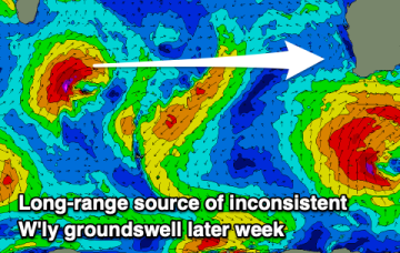
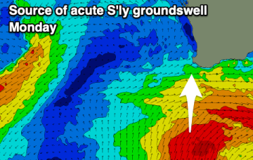
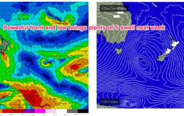
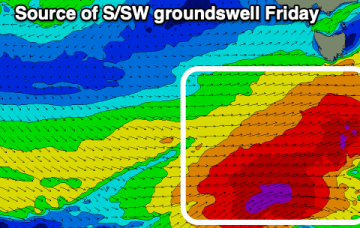
The surf isn't expected to improve until Monday in the South West, but with a large, acute S'ly groundswell.
Some small E’ly tradeswell is also likely to build into the first week of winter as an E’ly fetch builds across the Coral Sea, suggesting a round of fun surf for CQ.
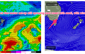
As it does it aims up the fetch of E/NE winds into the NETas swell window and we’ll see increasing swells from the NE direction o/night and into Sat.
We’ll see plenty of residual swell from this low-carb nor-easter, with a slow easing trend over the weekend, more pronounced into next week.
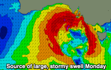
The first proper stormy in a long time will impact the gulf on Monday.