Not a great forecast period for Queensland and the North Coast

South-east Queensland and Northern NSW Surf Forecast by Ben Matson (issued Monday 8th August)
Best Days: No great days, though there'll be brief windows of opportunity for the Northern NSW beachies throughout the week. Wed AM and Fri currently the pick of an ordinary bunch.
Recap: Strong S/SE swells over the weekend, up to 4-6ft at swell magnets south of Byron Bay, with 3-4ft waves on the Tweed Coast and 2-3ft at exposed parts of the Gold and Sunshine Coast. Surf size has eased slowly today.
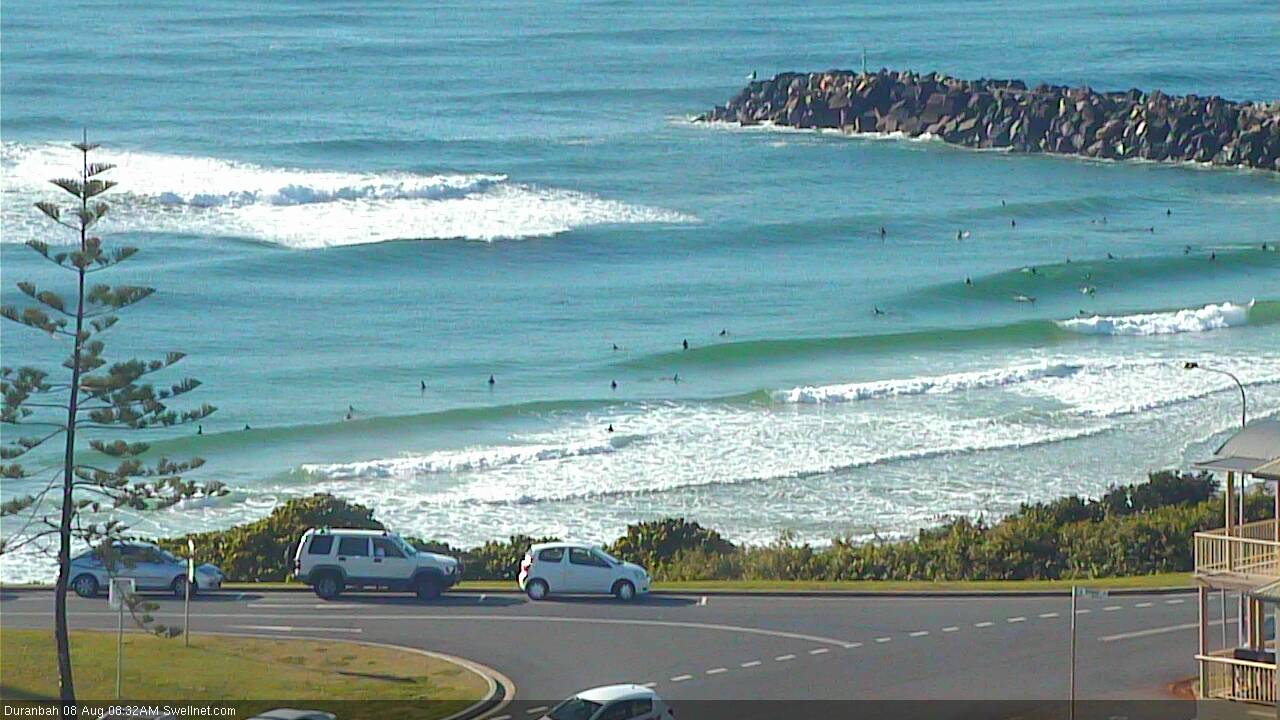
D'Bah was small but super clean and peaky this morning
This week (Tues 9th - Fri 12th August)
After an active period of out of the south, we’ve got a quiet period of waves ahead for most regions.
A moderate pulse of S/SE swell is expected to build later Tuesday afternoon across the Mid North Coast, reaching the Far North Coast overnight and then peaking in the early hours of Wednesday morning before trending slowly downwards throughout the day.
This swell will have been generated by a moderate front tracking northwards through the south-eastern Tasman Sea today; it's aimed mainly towards northern regions (i.e. New Caledonia) but we’ll still see some sideband S/SE thru’ SE energy from it push into the coast.
Compared to recent days, this swell will lack a lot of push but south facing beaches south of Byron should reach up to 3ft+ at times, though I am a little concerned that the timing of this pulse may result in peak surf size occurring overnight Tuesday in the Far North. Prior to its arrival, most of Tuesday will see smaller residual surf from today as the current swell eases, with early light winds swinging into an afternoon NE sea breeze in Northern NSW.
Across SE Qld, we won’t see much size from this source at most beaches, with occasional 2ft sets at south swell magnets at best - and probably not until Wednesday morning - by which time we’ll have moderate N/NW winds on hand. So again, you’ll need to seek some shelter from the wind. Expect very small leftover surf across most of the Gold Coast and Sunshine Coast on Tuesday, and then small easing swells on Wednesday afternoon.
Wednesday’s easing S/SE swell will be accompanied by early NW tending N’ly winds across Northern NSW so if you’re going to aim for a paddle, try and get in early morning for the best conditions - again, only protected northern corners will be worthwhile. And the bank situation is a little dubious right now following last week's large swells, so you may have to do some legwork to find anything worthwhile.
For the most part, Thursday looks pretty uneventful as we’ll be between swells, and winds look funky with a SW tending S’ly change expected along the Northern NSW coast during the day. A small low forming off the North Island of New Zealand has been slowed in its development; it’s now expected to reach peak strength early Wednesday morning, aimed towards Northern NSW but with less wind strength than Friday’s models suggested.
We’ll eventually see some slow associated E/SE swell fill in throughout Thursday afternoon, peaking on Friday with stray 2-3ft sets at a handful of reliable swell magnets in Northern NSW. There may be a mild hangover of southerlies across exposed stretches, so barring a forecast improvement in Wednesday’s notes, I wouldn’t go rearranging your diary just now.
These winds will obviously be much better for SE Qld on Friday, but surf size will be smaller here, perhaps some 2ft sets at exposed beaches and tiny waves at most locations. We may also see some mid-range south swell extending from Thursday’s frontal passage through the lower Tasman Sea but current indications don’t indicate much more than a couple of weak feet at south facing beaches south of Byron Bay.
So all in all, it’s not a great week of waves ahead. If you see something halfway decent in your travels, pounce on it!
This weekend (Sat 13th - Sun 14th August)
Saturday looks OK for south swell magnets south of Byron, with a small combo of easing SE and S’ly swells, and freshening NW winds. There may be a couple of feet on offer at these spots, but away from the swell magnets it’s likely to be tiny to flat.
This includes SE Qld, which won’t kick off the weekend with any appreciable surf at all.
Sunday doesn’t look much better either. A front will push into the Tasman Sea, driving a fresh southerly ridge across our coast, and although we’ll see an associated increase in south swell, those locations picking up the size will be wind affected from the south.
Away from south swell magnets in Northern NSW it’ll be clean and tiny, and across SE Qld we’re also looking at very, very small surf conditions for the second half of the weekend too.
Let’s hope the models do a major about-face on Wednesday, eh?
Next week (Mon 15th August onwards)
Saturday’s frontal passage is likely to be the precursor to stronger secondary and tertiary fronts, due over the following days that should generate stronger, long period southerly swells for Monday and Tuesday of next week.
These swells will only favour Northern NSW but there’s a suggestion that south swell magnets could see some solid sets in the 4-5ft range during the first half of next week.
At the same time, a ridge building through the Coral Sea should kick up some small short range energy for the Gold and Sunshine Coasts early next week, though no great quality is expected at this stage.
More on all of this in Wednesday’s update.
Comments
Could be a good w/end to have a quick early surf @ ****** then put some time in with the Missus, & maybe a few coldies!
Lovely conditions but very small on the Goldy this AM.
Some bloke's parked his fishing boat off Carties.
That's P&O's Pacific Jewel.
Cruise ships anchor off Mooloolaba these days and passengers are ferried to shore.
Even though these are relatively smaller cruise ships, it is a little startling how big they are when you see them popping incongrously into view.
You gonna need a bigger jeep.
Come on ben, give us Sunny coasters some good news for next week. I slept in on Monday and missed the beachies' morning sesison :(
Doing the forecast now.. will be up around half five.
Tuesday and today still had waves surprisingly, surfed 6-10am this morning was great fun, clean, no wind, just locals.