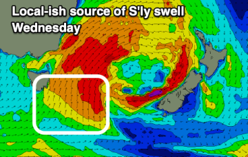
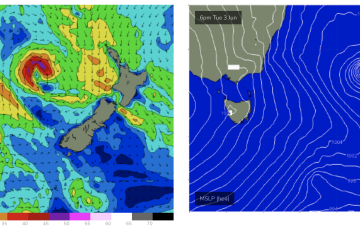
From mid next week we should see action return to the south as fronts push into the Tasman.
Primary tabs
/reports/forecaster-notes/eastern-tasmania/2025/06/16/not-much-week-small-ne-windswells-building-over
freeride76
Monday, 16 June 2025
/reports/forecaster-notes/eastern-tasmania/2025/06/13/last-the-e-swell-fades-out-weekend-small-ne
freeride76
Friday, 13 June 2025
Failing that we may see some small NE windswell next week from the high as it sets up a NE flow in the Tasmanian swell window.
/reports/forecaster-notes/eastern-tasmania/2025/06/11/great-surf-tomorrow
Craig
Wednesday, 11 June 2025
The surf will be great tomorrow and Friday morning before fading into the weekend.
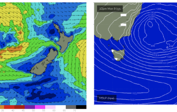
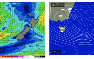
/reports/forecaster-notes/eastern-tasmania/2025/06/09/large-surf-week-improving-in-quality-it-goes
freeride76
Monday, 9 June 2025
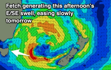
We’ll see the low move slowly out to sea later tomorrow with large stormy swells for East Tas slowly easing and improving in quality.
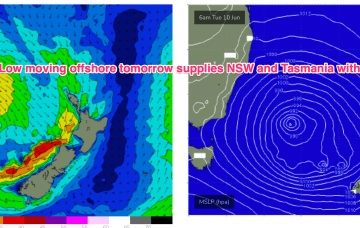
/reports/forecaster-notes/eastern-tasmania/2025/06/06/large-and-stormy-swells-expected-build-sun-low
freeride76
Friday, 6 June 2025
We’ll then see a few days of elevated surf with strong winds to low end gales in the southern flank of the low aimed up at Tasmania.
/reports/forecaster-notes/eastern-tasmania/2025/06/04/better-quality-s-sse-swells-ahead-next-week-now
freeride76
Wednesday, 4 June 2025
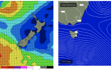
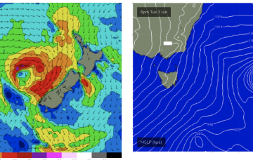
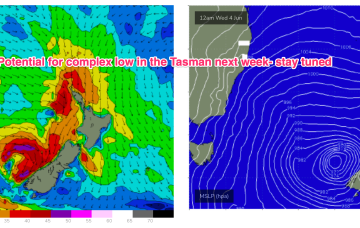
A low moves through Bass Strait Sun and looks to stall for days with swell producing winds aimed up straight at Tasmania’s east coast.
/reports/forecaster-notes/eastern-tasmania/2025/06/02/plenty-s-swell-short-term-conditions-improving
freeride76
Monday, 2 June 2025
A front moving into the Tasman Tues then interacts with the low, causing a robust deepening of the low and a complex pattern as a trough spins off the low and moves north while a further trough of low pressure forms off to the south.
/reports/forecaster-notes/eastern-tasmania/2025/05/30/s-pulses-ahead-over-the-weekend-and-next-week
freeride76
Friday, 30 May 2025
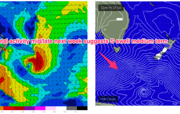
We’ve currently got a deep polar low with two strong embedded fronts tracking NE into the lower Tasman. High pressure moves up over NSW with light winds Sat, tending NW Sun as high pressure moves to the NE and a front passes to the south.
/reports/forecaster-notes/eastern-tasmania/2025/05/28/pulses-the-south-continue-plenty-grunt-expected
freeride76
Wednesday, 28 May 2025
It’s an impressive fetch with severe gale to storm force winds in a wide band moving NE, only offset by winds being not perfectly aimed up the pipe.
/reports/forecaster-notes/eastern-tasmania/2025/05/26/fun-easing-ene-swell-followed-sth
Craig
Monday, 26 May 2025
Tomorrow will be great across open beaches ahead of a windy south swell Wednesday, best as it eases.