Back to looking dynamic next week. The crux of it is another very strong high moving at Tasmanian latitudes early next week. That will be the anvil for any hammer that forms next week.
Primary tabs
/reports/forecaster-notes/south-east-queensland-northern-new-south-wales/2025/08/15/small-clean-e
freeride76
Friday, 15 August 2025
/reports/forecaster-notes/south-east-queensland-northern-new-south-wales/2025/08/13/fun-sized-clean
freeride76
Wednesday, 13 August 2025
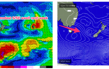
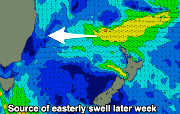
The fetch responsible for the current E swell is well out in the South Pacific and migrating eastwards with diminishing swells from that source.
/reports/forecaster-notes/south-east-queensland-northern-new-south-wales/2025/08/11/small-fun-e
freeride76
Monday, 11 August 2025
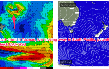
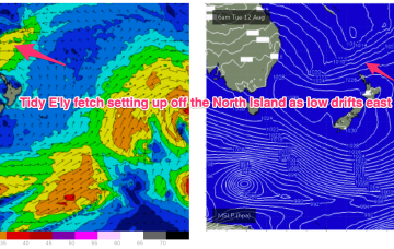
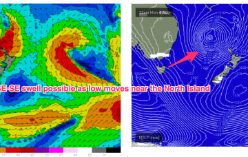
As noted on Fridays forecast another unseasonal low pressure system formed off the QLD coast over the weekend and has now drifted over to a position roughly equidistant between New Caledonia and the North Island.
/reports/forecaster-notes/south-east-queensland-northern-new-south-wales/2025/08/08/workable-windy
thermalben
Friday, 8 August 2025
The weekend won't be perfect but workable across the regions.
/reports/forecaster-notes/south-east-queensland-northern-new-south-wales/2025/08/06/easing-e-swells
freeride76
Wednesday, 6 August 2025
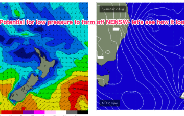
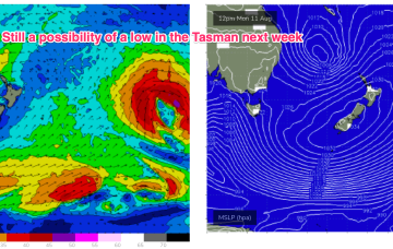
In addition another sub-tropical low is expected to form over the weekend, this time off the QLD coast before drifting off towards the east and reconsolidating near the North Island.
/reports/forecaster-notes/south-east-queensland-northern-new-south-wales/2025/08/04/large-e-swells
freeride76
Monday, 4 August 2025
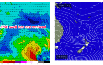
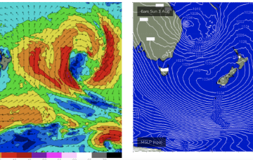
Current ASCAT (satellite wind speed) pass shows a low in the Northern Tasman with SE gales proximate to the NSW Coast and a long, broad fetch of E’ly gales extending from the Tasman out to a position north of the North Island.
/reports/forecaster-notes/south-east-queensland-northern-new-south-wales/2025/08/01/intense-sub
freeride76
Friday, 1 August 2025
If anything that eastwards movement looks slower than modelled on Wed so large surf will persist at elevated levels for longer.
/reports/forecaster-notes/south-east-queensland-northern-new-south-wales/2025/07/30/extended-large
freeride76
Wednesday, 30 July 2025
That will lead to elevated surf from the SE-E for most of next week with just a very slow, gradual tapering off as the fetch slowly weakens while remaining basically semi-stationary.
/reports/forecaster-notes/south-east-queensland-northern-new-south-wales/2025/07/28/bit-and-pieces
freeride76
Monday, 28 July 2025
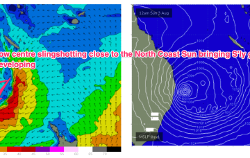
There’s broad model agreement now for a low to form off the sub-tropical coast and merge with a Coral Sea low pressure centre, deepening explosively through Sat and into Sun.
/reports/forecaster-notes/south-east-queensland-northern-new-south-wales/2025/07/25/spell-small-surf
freeride76
Friday, 25 July 2025
Inshore we’ll see those winds between 10-15 kts through the morning tending stronger N’ly through the day and generating small NE windswells for the MNC up to Yamba, not much further north of there.