Good swell for tomorrow, cleaner as it eases Friday

Western Australia Surf Forecast by Craig Brokensha (issued Wednesday 15th June)
Best Days: Protected spots tomorrow morning, exposed breaks Friday, protected northern corners in the South West Saturday morning
Recap
A solid pulse in new SW groundswell yesterday with 6ft sets across the South West but with gusty S'ly winds, leaving protected locations with the only decent waves. Perth and Mandurah were better with morning S/SE winds and 2ft sets.
Today cleaner conditions were seen across all coasts, but S/SE winds continued to limit the best surf to protected spots, with 4-5ft sets at exposed breaks and 1-2ft surf to the north.
This week and weekend (Jun 16 - 19)
Our strong SW groundswell due tomorrow is still on the cards, with long-period and good 6ft sets due across the South West along with 1-2ft waves around Perth and Mandurah.
Unfortunately S/SE winds will persist across the South West, with better E/SE offshores further North, while Friday looks much better down south with a straighter E'ly persisting all day. The surf will be on the ease though with 5ft sets on the in the South West and 1-1.5ft around Perth, with a reinforcing S/SW groundswell keeping the surf around this size most of the day before easing into Saturday.
Conditions Saturday will deteriorate though with a gusty N/NE tending N'ly wind.
W'ly winds on Sunday will then create poor conditions as a new mid-period W'ly swell fills in.
This swell will be generated by the stalling but weakening mid-latitude low in the southern Indian Ocean, with a fetch of strong to sub-gale-force W'ly winds around its northern flank due to be aimed through our swell window.
We're probably not looking at much size above 4ft in the South West and building 2ft sets in Perth but with that poor onshore wind.
Next week onwards (Jun 20 onwards)
 Onshore winds and small to moderate levels of W'ly swell will persist into Monday, while some new moderate sized S/SW groundswell is due later in the day/Tuesday ahead of some better energy Wednesday.
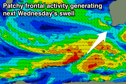
These swells will be generated by a disjointed flurry of polar frontal activity developing late in our swell window. Only a smallish pulse is due initially later Monday and Tuesday to 3-5ft across exposed breaks in the South West, 1ft in Perth.
Wednesday's pulse is only mid-period energy and not expected to offer much more than 5-6ft, but conditions look average in any case with a fresh onshore SW'ly breeze. We'll have a closer look at this Friday.