More S pulses ahead 
Wednesday, 10 September 2025

More S pulses ahead
Wednesday, 10 September 2025
Into the weekend and we’ll see fast moving lows racing under Tasmania Thurs and Fri/Sat.
Into the weekend and we’ll see fast moving lows racing under Tasmania Thurs and Fri/Sat.
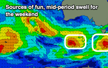
The coming days are very active, with more swell on the way into the longer term.
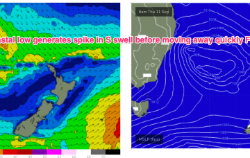
We should then see a low centred just off Sydney rapidly deepen o/night into tomorrow morning with NW’ly winds across the region shifting W-SW through the day. The low moves away quickly tomorrow with winds moderating quickly into and through Friday.
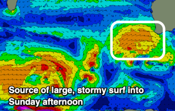
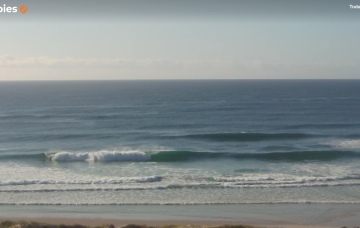
A fun mix of swells and clean conditions will create favourable surf tomorrow ahead of a return to oversized, stormy surf.
We should then see a low centred just off Sydney rapidly deepen o/night into tomorrow morning with W’ly gales north of the low and SW-S gales south of the low. The low moves away quickly tomorrow with SW-S gales tending to strong winds from the same direction through the day.
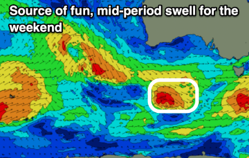
The weekend looks great for the South Coast, especially Saturday ahead of an active run of surf next week and beyond.
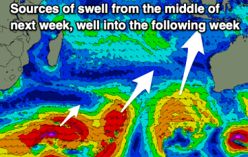
The end of the week isn't great, while the weekend looks super fun, with an overactive period expected from mid-late next week through the weekend and following week.
Large groundswell for tomorrow, with plenty of activity from the weekend and into next week and beyond.
So for all intents and purposes we can expect an ordinary run of waves in the short term, with mainly small residual swells (NE windswell and minor S’ly groundswell) along with freshening northerly winds on Tuesday and Wednesday.
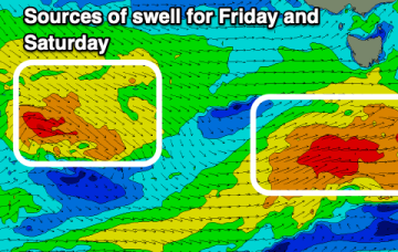
The main feature on this week's synoptic charts is a cut-off low that’s expected to intensify off Southern NSW around Thursday, delivering a rapid increase in short range southerly swell and associated SW tending S’ly winds.