Easing but improving surf
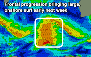
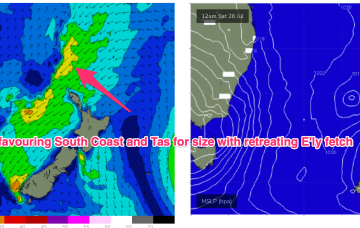
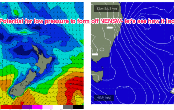
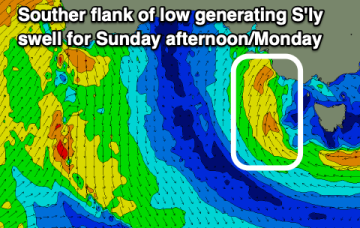
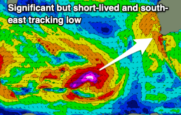
The current large swell will ease steadily into tomorrow as winds slowly improve, best Wednesday morning but smallest. A new SW swell will arrive through the day though.
The coming outlooks favours the South Coast with good to great surf due from later week into the weekend.
Over the weekend there’s now growing agreement on a coastal low (possibly some variant of an ECL) to form off the NENSW or SEQLD coast and intensify as it moves into the Tasman, with potential for severe weather and sizey swells.
The coming week would be better spent in the snow than surf.
Besides early tomorrow the weekend looks average with deteriorating winds. Large surf is due early next week but with strong winds.
High pressure has drifted up over NENSW and into the Tasman and an approaching trough and cut-off low really ramps up the pressure gradient short term, leading to fresh/strong N/NE-N’ly winds off the coast.
Inshore we’ll see those winds between 10-15 kts through the morning tending stronger N’ly through the day and generating small NE windswells for the MNC up to Yamba, not much further north of there.
Low pressure formation looks likely, possibly a strong cut-off low moving into the Tasman Thurs and offering an initial spike in S swell Thurs before better angled S/SE swell into the weekend if the low hangs around in the south-east Tasman near the South Island.
The coming period isn't that productive surf wise with a poor weekend, best early next week.