Dynamic outlook ahead with swells from a wide range of sources
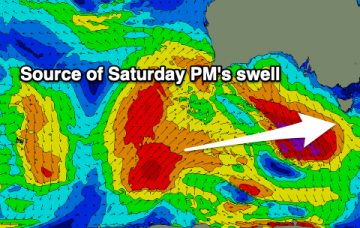
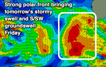
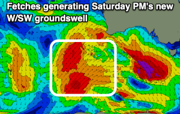
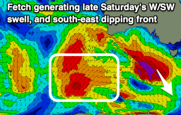
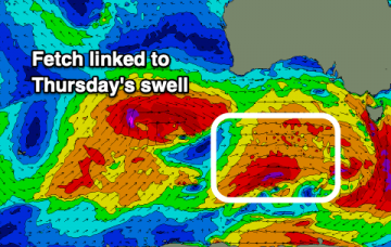
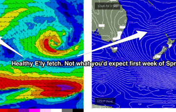
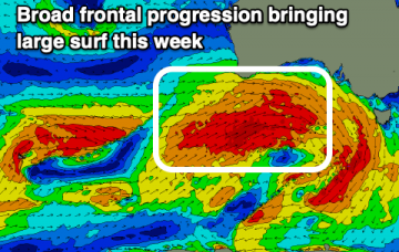
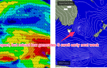
Spring starts with pattern change and an unstable, dynamic synoptic outlook with several swell sources incoming.
A good W/SW groundswell tomorrow with strong N/NE winds, easing into Friday. Some fun new W/SW swell is due on the weekend working the winds, possibly large early-mid next week.
Oversized, stormy SW groundswell tomorrow with a reinforcing S/SW groundswell Friday, easing as winds slowly improve. Good pulses of swell from Monday and mid-late week with good conditions.
A large, easing W/SW groundswell tomorrow with strong, warm winds out of the north ahead of an evening change, smaller into Friday and the weekend with varying winds. New large swell next Tuesday, cleanest as it eases.
A large W/SW groundswell is expected tomorrow with warm, strong offshore winds out of the north. Following this the outlook isn't quite as favourable until mid-late next week.
Tiny surf ahead of some building W/SW swell Wednesday afternoon but more so Thursday.
We'll see poor conditions continuing across most regions over the coming days as the swell also grows larger. A slow improvement in conditions is expected from late week and more so on the weekend.
N’ly winds then freshen again Thursday with a much stronger fetch adjacent to the NSW coastline and extending down to the Tasmanian coast brings a stronger flush of NE windswell.
This incredible high pressure system, 1036 and 1042 hPa, then begins to extend a long, broad fetch of SE/ESE winds adjacent to the North Island and extending through the South Pacific and into the Northern Tasman and Southern Coral Sea. This portends another extended E’ly swell event, more focussed on NENSW and SEQLD but with enough width in the fetch to ensure the entire NSW coast gets sprayed with swell from the Eastern Quadrant.
A very active period of surf with building westerly swells over the coming days as winds provide plenty of options for the South Coast and a few windows on the Mid Coast.