Great swells and surf this week
Monday, 6 September 2021
Great swells and surf this week
Monday, 6 September 2021
Some chunky groundswells and with favourable winds this week for the experienced.
Some chunky groundswells and with favourable winds this week for the experienced.
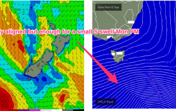
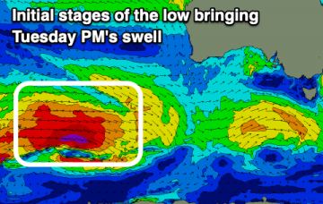
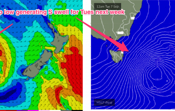
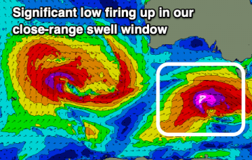
Models have rejigged the frontal progression into the Lower Tasman next week with a less favourably aligned storm track for NETas.
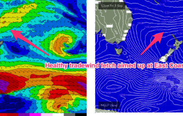
An incredibly strong high pressure cell (1043 hPa) near New Zealand is driving an impressive tradewind fetch through the North Island/South Pacific corridor , as well as local onshore winds through the Coral and Northern Tasman sea.
Lots of swell on the way this period with generally favourable and workable winds.
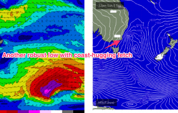
By Mon morning the Tasman sea will be inflamed with severe gale to potentially storm force winds, as a robust low and reinforcing cold front push into the lower Tasman.
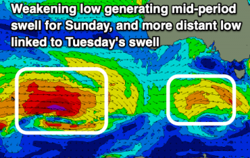
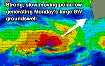
An improvement in conditions across the South West on the weekend with easing surf ahead of a large new SW groundswell early next week with winds from the north-eastern quadrant.
A S'ly change will move in mid-late morning tomorrow as a new W/SW groundswell builds. Cleaner conditions and a strong swell is due early-mid next week.
Once an onshore change moves through today, conditions will be poor and average until Tuesday, slowly improving. This will be along with a good mix of new groundswells.
Initially, winds on the Western (East Coast Aus) side of the Tasman begin to freshen from the North and we’ll see that through the rest of the working week as the high pressure ridge gets squeezed by an approaching trough and front.
On the New Zealand side of the basin, troughy remnants of last week’s low pressure cell invigorate a long, broad tradewind fetch extending from the South Pacific into the Northern Tasman and Coral Sea. While this fetch looks a little less impressive and more mobile than it did on Wed it’s still going to be a solid swell producer for the sub-tropical East Coast.