Large, windy end to the week
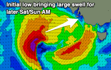
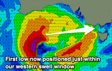
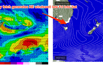
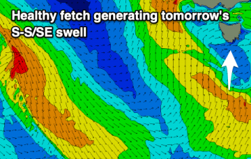
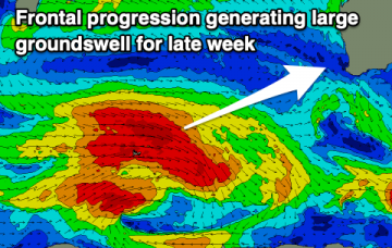
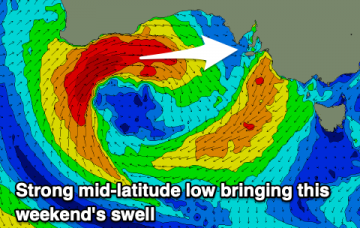
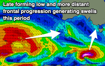
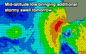
We'll see a large mix of swells develop tomorrow with stormy conditions, improving across selected locations earlier than the South West region.
A slow end to the week ahead of a windy and building weekend of surf, larger into early next week. Later next week is possibly shaping up great.
We've got a slow end to the week but with favourable winds for the beaches. From Sunday onwards we'll see an overactive period of swell generating storms and more than workable winds.
High pressure straddling Tasmania brings a weak and variable wind flow through the week up to Fri, with tiny surf expected and settled conditions.
A mix of swells are on the cards for tomorrow along with cleaner conditions. The rest of the period is slower ahead of an active week next week.
This week will be dominated by a low in the Tasman, which is expected to form tomorrow along a NW-SE angled trough line extending from far NENSW across the Tasman sea down to the North Island.
This low and a slow moving high pressure cell- now drifting across the Bight and expected to track over Tasmania mid-week will hold a pattern of S’ly winds and developing SE swell through the week.
Make the most of a window of lighter winds tomorrow before conditions deteriorate into the middle to end of the week, lasting for more than a few days.
Easing surf with light winds over the coming days, remaining small until the weekend with a mix of swells will develop. Next week looks active as well.
Not the best week of surf with less than ideal winds and conditions along with slower swells. The weekend looks better ahead of a much more active outlook next week.