Get out there today
Monday, 21 April 2025
Get out there today
Monday, 21 April 2025
Today is the pick of the period before winds go funky over the coming days.
Today is the pick of the period before winds go funky over the coming days.
The Mid will be tiny all week with fun days opening up for the South Coast.
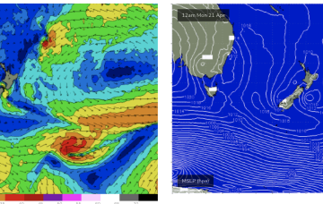
We’ve got a more subdued synoptic outlook this week with weak high pressure currently in the Tasman and a complex troughy area of low pressure situated off the Southern NSW/Gippsland coast. That trough moves NE, backed by a large high pressure centre currently in the Bight. We’ll see the trough bring onshore winds and swell as it moves up the NSW Coast through the first half of this week.
The coming days will have swell but conditions look very average, better later week.
We’ve already reached the peak of this impressive event and so we’re looking at a steady drop in size both Saturday and Sunday.
The large mid-latitude low in the central Tasman Sea - responsible for today’s very large surf - is slowly rotating clockwise, and by this evening won’t actually have a fetch aimed within our swell window.
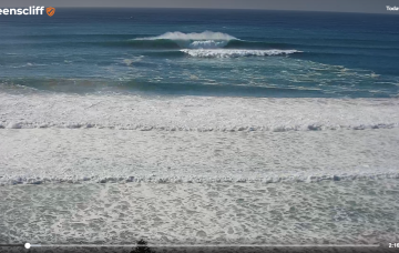
It's large and windy this afternoon but the weekend looks great as the current swell eases steadily.
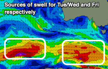
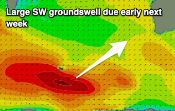
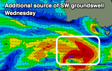
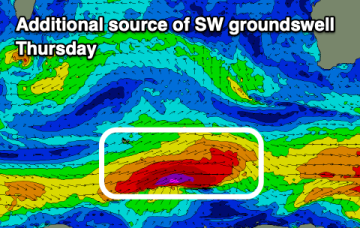
The coming weekend looks small to tiny ahead of a strong new SW groundswell Tuesday/Wednesday.
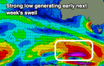
The coming weekend will be best on the magnets, with a good new swell due into Monday.
Make the most of the current swell and good conditions before things deteriorate from Sunday.