Large, windy west swell tomorrow
Monday, 21 July 2025
Large, windy west swell tomorrow
Monday, 21 July 2025
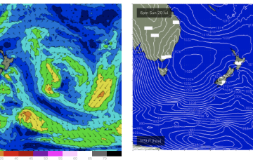
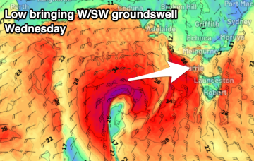
A strong mid-latitude low will move in tomorrow bringing with it a large increase in windy westerly swell.
A strong mid-latitude low will move in tomorrow bringing with it a large increase in windy westerly swell.
The coming period will provide plenty of surf days to the east of Melbourne.
Make the most of the current and coming swells before they fade.
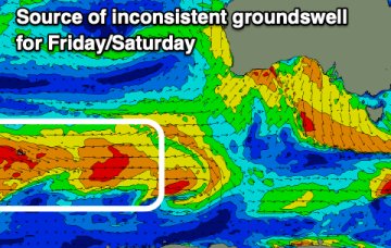
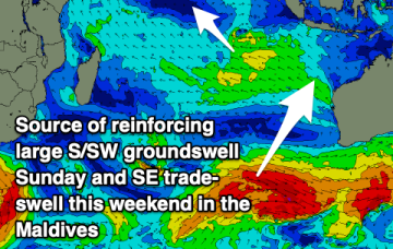
The rest of the week should hold surfable levels of E/NE-NE swell from winds feeding into a low pressure trough in the Tasman.
Tomorrow is worth capitalising on before the next episode of frontal activity moves in.
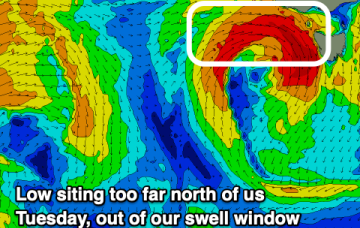
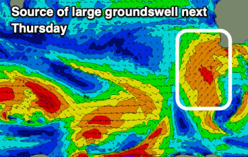
There’s still some model divergence later next week but for now we’ve got reasonable confidence a broad fetch will develop through the Northern Tasman as high pressure moves into the Tasman and supplies an anchor for the low.
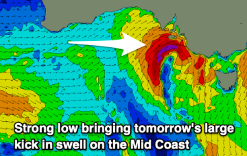
The weekend will remain solid with reinforcing pulses of swell and a window for the Mid Coast.
There’s still some model divergence later next week but for now we’ve got reasonable confidence a broad fetch will develop through the Northern Tasman as high pressure moves into the Tasman and supplies an anchor for the low.
There'll be plenty of opportunities for a surf over the coming days.