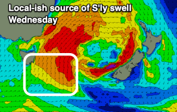
Tomorrow will be great across open beaches ahead of a windy south swell Wednesday, best as it eases.
Primary tabs
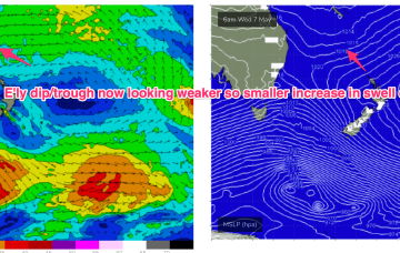
/reports/forecaster-notes/eastern-tasmania/2025/05/26/fun-easing-ene-swell-followed-sth
Craig
Monday, 26 May 2025
/reports/forecaster-notes/eastern-tasmania/2025/05/23/pumping-surf-the-ne-ene-over-the-weekend-strong
freeride76
Friday, 23 May 2025
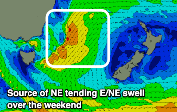
As it does it aims up the fetch of E/NE winds into the NETas swell window and we’ll see increasing swells from the NE direction o/night and into Sat.
/reports/forecaster-notes/eastern-tasmania/2025/05/21/dynamic-period-solid-ne-then-s-swell
Craig
Wednesday, 21 May 2025
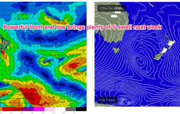
We'll see building levels of NE tending E/NE swell this period follow by a windy, cold S'ly swell.
/reports/forecaster-notes/eastern-tasmania/2025/05/19/quality-ene-swell-likely-end-the-week-lowtrough
freeride76
Monday, 19 May 2025
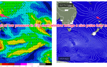
These small lows may move north, then east and finally south or may coalesce in a more classic Tasman Low or ECL variant. Either way we should see some quality E/NE swell for Tas as the fetch draws out through the Tasman.
/reports/forecaster-notes/eastern-tasmania/2025/05/16/nice-ene-swell-due-next-week-tasman-low-drifts
freeride76
Friday, 16 May 2025
By mid week the trough of low pressure in the Tasman is expected to be moving southwards towards the NSW south coast.
/reports/forecaster-notes/eastern-tasmania/2025/05/14/small-s-swell-pulses-incoming-possible-ecl-nsw
freeride76
Wednesday, 14 May 2025
Next week still looks dynamic with potential for a deep trough or low in the Tasman, although we are going to have to play it day by day due to poor model to model and run to run consistency.
/reports/forecaster-notes/eastern-tasmania/2025/05/12/small-fun-swells-filter-down-the-tropics-s
freeride76
Monday, 12 May 2025
A broad trade fetch on steroids is now slowly breaking down through the Coral, Tasman and South Pacific with a tropical low whizzing away to the SE.
/reports/forecaster-notes/eastern-tasmania/2025/05/07/mix-s-swells-and-small-ene-swells-the-tropics
freeride76
Wednesday, 7 May 2025
In between, a trough and cold front are currently approaching Tasmania, expected to bring a vigorous W/SW-SW flow o/night into tomorrow, bringing a spike in short range S swell short term.

/reports/forecaster-notes/eastern-tasmania/2025/05/05/small-mixed-bag-week-fresh-offshore-winds
freeride76
Monday, 5 May 2025
We’ll see the current dominant high (1034hPa) straddling New Zealand which is directing a broad trade fetch through the South Pacific and into the Coral Sea slowly migrate eastwards this week with an E’ly dip forming a trough of low pressure due E of SEQLD mid week.
/reports/forecaster-notes/eastern-tasmania/2025/05/02/surf-easing-back-tinyflat-the-weekend-under
freeride76
Friday, 2 May 2025
We should see some better quality E/NE swell from a southwards moving low pressure trough which moves from the South Pacific into the Northern Tasman next week.