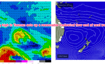
Further ahead and GFS is suggesting a robust high in the Tasman with a trade flow supplying some small surf for the CQ region developing next weekend with another, stronger high moving at Tasmanian latitudes suggesting another SE surge and potential swell from the eastern quadrant.
Primary tabs
/reports/forecaster-notes/central-queensland/2025/09/05/fun-increase-sun-longer-term-offers-chance
freeride76
Friday, 5 September 2025
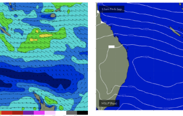
/reports/forecaster-notes/central-queensland/2025/09/01/small-increase-sun-se-surge
freeride76
Monday, 1 September 2025
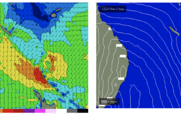
Still some hope though with another strong high moving E of Tasmania on Sat and generating a SE surge up the QLD coast this weekend.
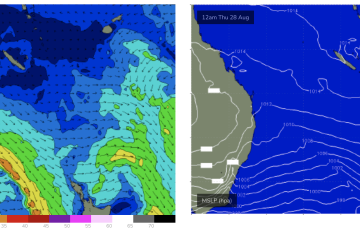
/reports/forecaster-notes/central-queensland/2025/08/29/weak-trade-flow-next-week-may-supply-just
freeride76
Friday, 29 August 2025
Next weeks high pressure centre in the Tasman now looks weaker and the trade flow in the Coral Sea is weaker and more disjointed.
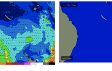
/reports/forecaster-notes/central-queensland/2025/08/27/tinyflat-week-signs-life-later-next-week
freeride76
Wednesday, 27 August 2025
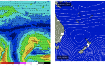
The initial SE surge is confined to more northerly waters but as the week progresses SE winds should extend though more of the Coral Sea and generate rideable waves for CQ.
/reports/forecaster-notes/central-queensland/2025/08/25/tinyflat-week
freeride76
Monday, 25 August 2025
High pressure is moving up over QLD and E’ly winds are deserting the Coral Sea. That will see a period of tiny/flat winter-style surf set in this week and into the weekend.
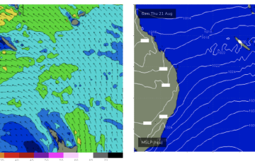
/reports/forecaster-notes/central-queensland/2025/08/22/surf-easing-over-the-weekend-tiny-next-week
freeride76
Friday, 22 August 2025
High pressure is now moving away and the fetch in the Coral Sea is expected to ease over the weekend and migrate south and eastwards.
/reports/forecaster-notes/central-queensland/2025/08/20/surf-pattern-through-the-weekend
freeride76
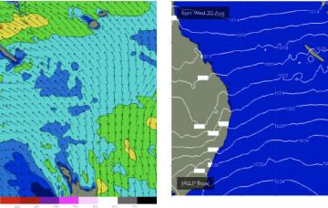
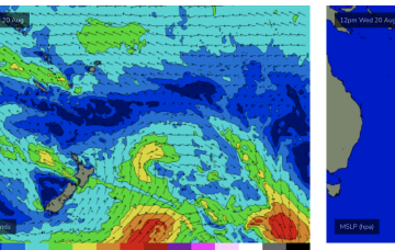
Wednesday, 20 August 2025
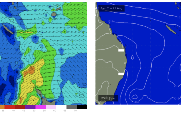
Very La Niña-esque synoptic pattern with a strong 1035hPa high sitting in the Tasman directing an E’ly flow into a coastal trough stretched from Central QLD to the South Coast NSW.
/reports/forecaster-notes/central-queensland/2025/08/18/plenty-surf-now-expected-week
freeride76
Monday, 18 August 2025
Once the high sets up the ridge we’ll see onshore winds and a deep E’ly flow through the Northern Tasman and Coral Seas.
/reports/forecaster-notes/central-queensland/2025/08/15/uncertain-outlook-next-week-surf-possible
freeride76
Friday, 15 August 2025
That will be the anvil for any hammer that forms next week. We may see a trough form along the QLD coast in the sub-tropics with a strong E/NE-NE infeed developing from the Coral Sea/Northern Tasman (ECMWF scenario).
/reports/forecaster-notes/central-queensland/2025/08/13/back-tinyflat
freeride76
Wednesday, 13 August 2025
Unfortunately the expected SE surge and strong high pressure with Tradewinds in the Coral Sea has evaporated next week so we’re at surf going back to tiny/flat from late this week into next week.