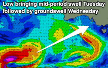
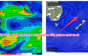
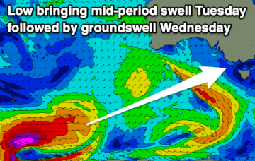
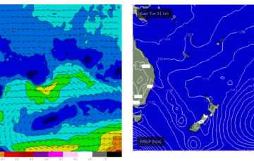
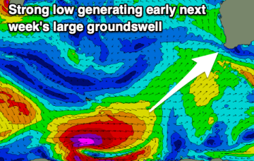
Easing surf with a large swell for early next week
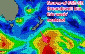
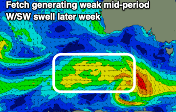
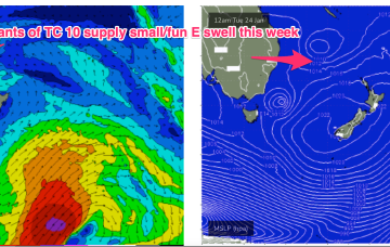
Clean conditions but smaller surf tomorrow, poor Friday with a window Saturday morning. Better surf is due into early next week.
The synoptic pattern over and surrounding Australia still has a strong La Niña signature with troughy low pressure areas in the Tasman Sea and an active monsoon trough across Northern Australia. High pressure on the other side of New Zealand is cradling areas of low pressure and maintaining a small, fun E swell signal.
There's only really one window for the South Coast this period, with a few little Mid waves to pick and choose from.
The synoptic pattern over and surrounding Australia still has a clear La Niña signature with troughy low pressure areas in the Tasman Sea and an active monsoon trough across Northern Australia. High pressure on the other side of New Zealand is cradling areas of low pressure and maintaining a small, fun E swell signal.
Make the most of this morning and the small windows over the coming days before S'ly winds kick in later weekend, through most of next week.
A troughy pattern exists through the Coral Sea to Northern Tasman down to the South Coast with the remnants of TC 10P (named by JTWC but remained a cyclone for less than a day) drifting in a SW direction from out near New Caledonia as a weak sub-tropical low. A diffuse monsoon low in the Coral Sea remains weak and is expected to head back inland towards the North tropical coast this week.
A troughy pattern exists through the Northern Tasman down to the South Coast with the remnants of TC 10P (named by JTWC but remained a cyclone for less than a day) drifting in a SW direction from out near New Caledonia as a weak sub-tropical low. A small low pressure cell near the South Coast is slowly drifting south bringing a variable NE flow and some useful E/NE swell as the fetch aims up at NETas.
Building surf from Wednesday afternoon with favourable winds each morning.
A troughy pattern exists through the Northern Tasman down to the South Coast with the remnants of TC 10P (named by JTWC but remained a cyclone for less than a day) drifting in a SW direction from out near New Caledonia as a weak sub-tropical low. A small low pressure cell near the South Coast is slowly drifting south leaving a variable flow in it’s wake across the f/cast region.