Keep those grovel boards handy as more small Summer surf is on the menu

freeride76

Keep those grovel boards handy as more small Summer surf is on the menu

freeride76

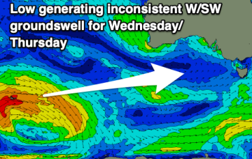
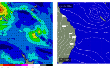
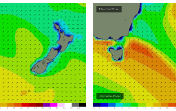
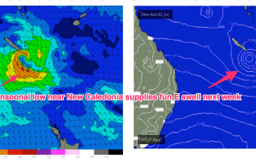
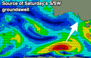
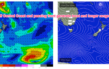
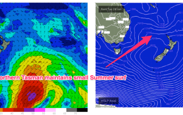
No great change to the weekend f/cast. The remnants of yesterdays troughy change are now lingering off the NSW North Coast and a weak high pressure ridge is maintaining a soft but persistent onshore flow along the Eastern Seaboard. Activity in the tropics has been intense but short-lived with TC Irene forming between New Caledonia and Vanuatu, now downgraded back to sub-tropical storm status and racing away to the SE (the grave-yard) without being a significant swell producer for the East Coast.

Rideable surf continues into the weekend as Tradewinds and monsoon trough combine

freeride76

Rideable surf continues into the weekend as Tradewinds and monsoon trough combine

freeride76

No great change to the outlook with plenty of rideable surf expected. High pressure remains anchored in places at Tasmanian latitudes with reinforcing cells maintaining a high pressure ridge along the QLD coast. Abutting this ridge is a series of monsoonal lows, which are enhancing windspeeds through the CQ swell window.

Very poor outlook

Craig

Very poor outlook

Craig

Persistent onshore winds will create poor conditions down South while there'll be no decent swells for the Mid Coast besides a tiny pulse later today and tomorrow morning.

Robust S'ly change Thurs with a low quality mixed bag ahead

freeride76

Robust S'ly change Thurs with a low quality mixed bag ahead

freeride76

Weak high pressure sits in the Tasman now, directing freshening NE winds across the Central/Southern NSW Coast as a trough and front approach from the W and SW. The trough will bring a robust S’ly change to the NSW Coast through Thurs, extending up into the sub-tropics during Fri. S’ly winds and swell quickly build in the wake of the trough.