Tricky swell sources and fun sized E swells keep surf zones active

freeride76

Tricky swell sources and fun sized E swells keep surf zones active

freeride76

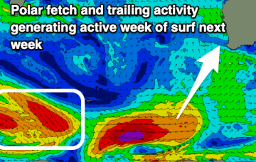
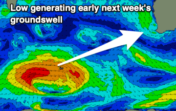
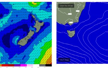
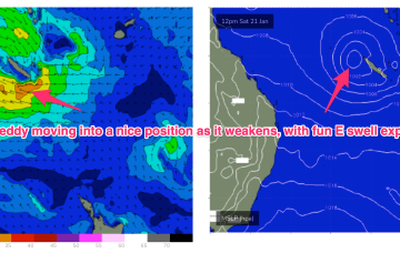
A troughy pattern exists through the Northern Tasman down to the South Coast with the remnants of TC 10P (named by JTWC but remained a cyclone for less than a day) drifting in a SW direction from out near New Caledonia. A small low pressure cell near the South Coast is slowly drifting south leaving a variable flow in it’s wake across the f/cast region.

Good swell tomorrow

Craig

Good swell tomorrow

Craig

Great conditions with a good new swell tomorrow morning, easing ahead of some inconsistent, small W/SW swell energy next week.

Plenty of small fun E swell ahead, as monsoon low/TC drifts towards New Caledonia

freeride76

Plenty of small fun E swell ahead, as monsoon low/TC drifts towards New Caledonia

freeride76

In the Coral Sea a depression on the end of the Monsoon Trough  is organising with a high likelihood of forming a tropical cyclone (TC Freddy) - this is looking like a handy swell producer for sub-tropical areas although no real size is expected as the system weakens as the swell producing fetch moves into the swell window.