Winter calibre surf for the coming days
Wednesday, 1 February 2023
Winter calibre surf for the coming days
Wednesday, 1 February 2023
Increasing swell energy with windy conditions and cooler weather for the coming period.
Increasing swell energy with windy conditions and cooler weather for the coming period.
The unstable pattern continues with a small trough of low pressure lingering off the Central NSW Coast, linked to tropical cloud bands and moisture streaming in from the Northern Monsoon. This unstable, humid pattern lasts through the week before a winter-calibre mid-latitude low blasts a clearing W’ly flow across most of the region. Workable pulses of funky E swells maintain surfable conditions until the pattern change beginning Friday, extending into the weekend.
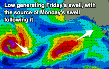
A ton of westerly swell followed by a south-west number on Sunday.
We’ve got a troughy, unstable synoptic pattern on our hands with monsoonal clouds and moisture extending from the Top End dawn to a trough off the NSW South Coast. Through the Coral Sea a NW monsoonal flow is bending from the tropics to become more N’ly. The upshot is more more tiny/flat surf for the CQ coast this week.
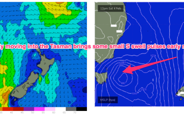
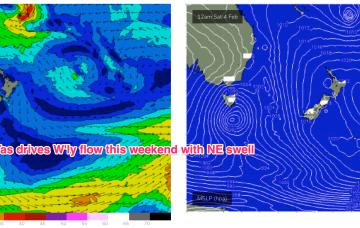
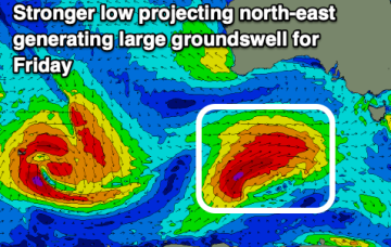
Small traces of E swell generated by fetches near the North Island supply some rideable surf if you can work around the shifty winds expected this week. A strong winter-calibre low becomes slow moving near Tasmania later this week bringing plenty of weather and S swell once it moves E of the state.
While today is a bit of a disappointment, there are fun surf days to come this week with a good swell for Wednesday.
We’ve got a troughy, unstable synoptic pattern on our hands with monsoonal clouds and moisture extending from the Top End dawn to a trough off the NSW South Coast. Weak pressure gradients look to be with us for a few days as the trough lingers about the NSW Central/Mid North Coast, possibly forming a small low. Small pulses of E swell generated by fetches near the North Island supply some fun sized surf if you can work around the shifty winds expected this week.
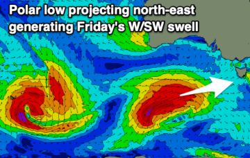
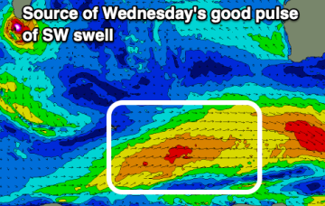
Great waves this afternoon on the Mid with deteriorating conditions mid-week along with further pulses of SW swell, large and stormy Friday.
We've got plenty of activity due this week, climaxing with a large SW groundswell and return to winteresque conditions and weather late week.
We’ve got a troughy, unstable synoptic pattern on our hands with monsoonal clouds and moisture extending from the Top End dawn to a trough off the NSW South Coast. Weak pressure gradients look to be with us for a few days as the trough lingers about the NSW Central/Mid North Coast, possibly forming a small low. Small pulses of E swell generated by fetches near the North Island supply some fun sized surf if you can work around the wind shifts expected this week.