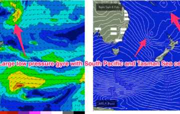
Deteriorating surf and winds through the weekend
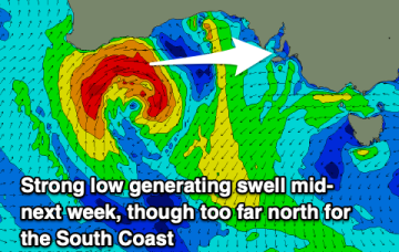
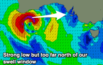
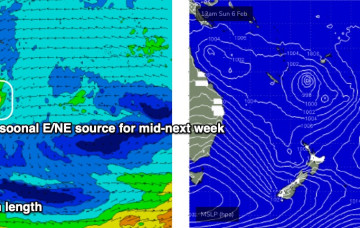
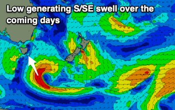
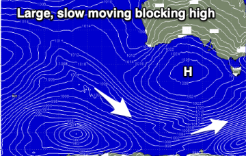
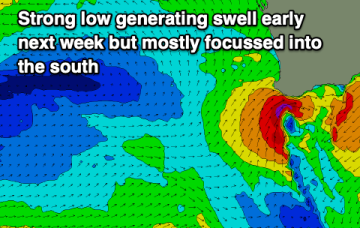
Easing surf with deteriorating conditions on the weekend, larger and windy early next week.
A monster high moving through the Bight is strengthening with the pressure gradient tightened along the entire ridge line by a low pressure trough with embedded low systems in it. The trough extends from the South Island New Zealand up to the monsoon trough across CapeYork Peninsula and into the Gulf of Carpenteria.
A severe low will form off the Western Australian coast and drift into our swell window Monday, generating a sizey westerly groundswell.
Winds will come out of the east to north-east over the coming days but with small levels of weak swell.
The main feature of the forecast period of a gusty southerly change that’s already arrived in Southern NSW, and will push across the Mid North Coast overnight, reaching Far Northern NSW mid-late morning and the Gold Coast around lunchtime.
As mentioned on Monday, we've got an unusual synoptic pattern setting up in the Tasman Sea.
A mix of swells over the coming days but mainly easing from the east-northeast and pulsing from the south.
There'll be plenty of surf from the south to south-east over the coming days with improving winds into the weekend.
There's a fun swell with clean conditions to end off the week, deteriorating through the weekend with a large stormy swell early next week.
Slowly improving conditions but with easing surf in size and energy, bottoming out once cleanest.