Humid, tiny week of surf
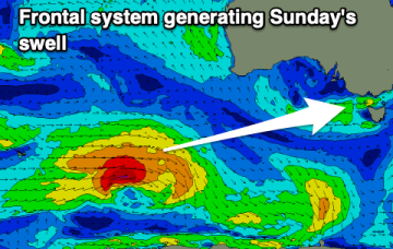
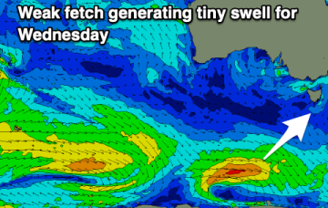
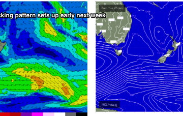
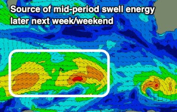
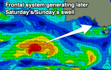
A slow moving trough with two embedded lows will move in from the west along with no decent swell. There's a bit more action into the weekend but with less than ideal winds.
The charts will be looking good as low pressure steams around the corner from New Caledonia and drops into the slot but we won’t see swell from that until the following week.
There's no major surf or swell due this week but we'll see a bit more action from Sunday into next week.
A major pattern change occurs next week with the intense storm track of the last month which has seen two huge cyclone gyres forming, and relentless storms charging at Hawaii, breaking down.
The blocking pattern remains in place for most of next week. First, the initial high maintains position just East of Tasmania with weak pressure gradients and only light N to NE winds in the swell window- not enough to generate any more than a foot or so of weak windswell.
An active sea state has now developed as 20-30 knot SE winds blanket the Central Coral Sea and that will see surf in the 2ft range continue through Sat, with slightly bigger 2-3ft surf on offer at the more exposed breaks with open Capricorn Channel exposure.
The outlook remains slow for the period with small windows for beginners.
This is maintaining the ridge of high pressure along most of the East Coast, with a slight and slow easing of pressure gradients expected over the weekend. An active Monsoon Trough lays across the North of the Continent extending out into the Coral Sea.
Today's swell will ease into the weekend with less favourable winds, with some new swell for early next week as winds strengthen from the south-eastern quadrant.
This is maintaining the ridge of high pressure along most of the East Coast, with a slight and slow easing of pressure gradients expected over the weekend.