Weak swells until early next week
Wednesday, 9 February 2022
Weak swells until early next week
Wednesday, 9 February 2022
A couple of flukey westerly swells before some more significant swell energy develops for early next week.
A couple of flukey westerly swells before some more significant swell energy develops for early next week.
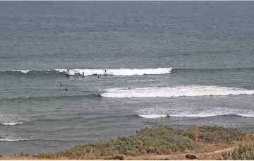
The weekend isn’t looking great with a small mixed bag of 1-2ft surf both days, lifting a notch Sun a’noon as NE wind swell builds in under freshening N’ly winds.
We've got good pulses of swell with decent winds over the coming period and plenty of options.
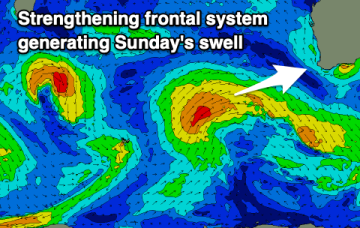
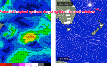
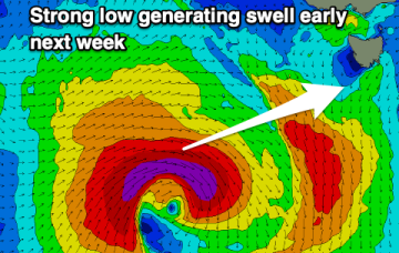
Another strong high pressure ridge is preparing to build along the CQ coast Fri with (another!) tropical low drifting south from the South Pacific later this week and over the weekend down the Tasman Sea pipe.
A building trend will be in place Sat, primarily from the ridge that develops between a strong high and the cyclone/low as it begins the journey south.
Today's large W'ly groundswell will ease over the coming days while shifting more SW in direction with improving winds for the South Coast on the weekend
Another strong ridge is expected to establish Fri with (another!) tropical low drifting south from the South Pacific later this week and over the weekend down the Tasman Sea pipe.
It's a tricky forecast period regarding the timing of swells and local winds but there are windows for those on the pulse.
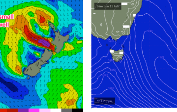
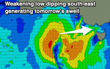
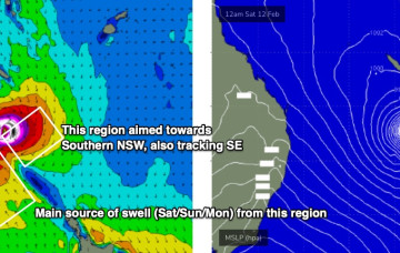
A broad region of low pressure in the central/northeastern Tasman Sea is maintaining easterly thru’ south-easterly gales (via two seperate fetches) aimed mainly towards Southern NSW, but a healthy percentage is pushing SE energy up into Northern NSW.
The weekend’s impressive anchored ridge encompassing the Tasman and Coral Seas is now abating in strength, however we’ve still got plenty of waves on the way.