Strong swells continue this week
Monday, 13 June 2022
Strong swells continue this week
Monday, 13 June 2022
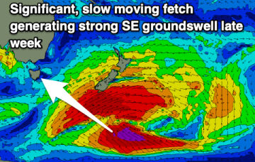
There's plenty more swell to come this period with a strong SE groundswell into the end of the week.
There's plenty more swell to come this period with a strong SE groundswell into the end of the week.
Today's swell and winds will ease tomorrow as a low clears to the east, followed by building and strengthening frontal systems and XL surf this weekend.
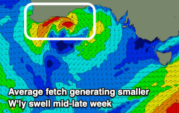
We're entering a slower period with no real significant stormy activity firing up in the Southern Ocean.
Easing surf with no considerable swells for the coming week most of next week.
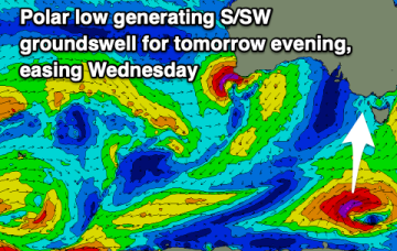
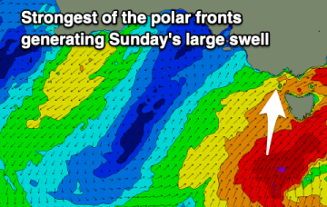
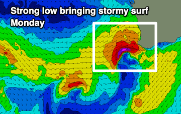
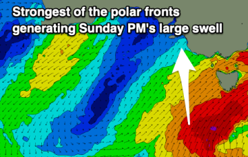
Sunday is a different story as storm force winds sweep past the state, bringing a S swell much larger than anything seen so far.
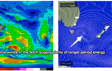
Current ASCAT (satellite wind speed) passes show gales to severe gales extending down to 55S with a tighter core of storm force winds just emerging from behind Tasmania as it tracks NE into the Tasman Sea. The synoptic flow from the fronts and Southern Gyre remains W to W/SW and that will continue all weekend with plenty of wind chill to boot.
Windy, cold and with low level snow but large prolonged surf.
Here comes that classic winter pattern we see every year. Onshore winds and building stormy surf from mid-latitude lows and fronts.
Current ASCAT (satellite wind speed) passes show gales to severe gales extending down to 55S with a tighter core of storm force winds just emerging from behind Tasmania as it tracks NE into the Tasman Sea. The synoptic flow from the fronts and Southern Gyre remains W to W/SW and that will continue all weekend with plenty of wind chill to boot.
An improvement in the wind outlook for Monday with some decent sized S'ly swell in the water.