Generally small surf, but a few fun windows to work around

Sydney, Hunter and Illawarra Surf Forecast by Ben Matson (issued Friday 8th January)
Features of the Forecast (tl;dr)
- Light winds and fun waves this weekend, though easing size
- Small peripheral swells for much of next week, with variable conditions
Recap: Building swells from several southerly sources reached 3-4ft on Thursday afternoon, and have held in around this size range today. Winds have however been mainly onshore so conditions haven’t been great.
This weekend (Jan 9 - 10)
No changes to the weekend outlook.
Conditions should become reasonably good across most coasts as winds tend light and variable under the influence of a new high pressure system moving in from the west. The only exception here is the Central Coast and Hunter region, which may see lingering S/SE winds early Saturday. Otherwise, expect light morning winds and light to moderate afternoon sea breezes.
As for surf, all of our current S’ly through SE swell sources have vacated their respective swell windows, so we’ll see easing size from the get go on Saturday. Early morning should see wave heights around 3ft at open beaches facing south (and perhaps a little more through the Hunter region) but it’ll be down to an inconsistent 2-3ft by the afternoon and then 2ft by Sunday morning. Expect smaller surf at beaches not open to the south.
A small undercurrent of trade swell will also provide 1-2ft surf at most open beaches all weekend.
Next week (Jan 11 onwards)
Next week looks a little small and slow.
A series of Southern Ocean fronts passing south of Tasmania will provide peripheral southerly swells all week, though without any notable size.
A high pressure system in the Tasman Sea will freshen N’y winds along the Southern NSW coast from Monday lunchtime onwards (early morning should be light and variable north of the Illawarra) and this fetch will remain relatively stationary all week, thus generating small, intermittent pulses of short range NE swell for most of the week. Wave heights should hover either size of 2ft but we’ll see a few periods slightly higher than this (i.e. more in the 2-3ft range). These peaks are currently pegged for Tues PM and Wed AM, and then later Thurs thru' Fri.
Local winds are not expected to become too strong all week - though they will affect most open beaches throughout the first half - however, lingering troughiness along the South Coast should provide occasional windows of light variable winds across much of the region (mainly the mornings).
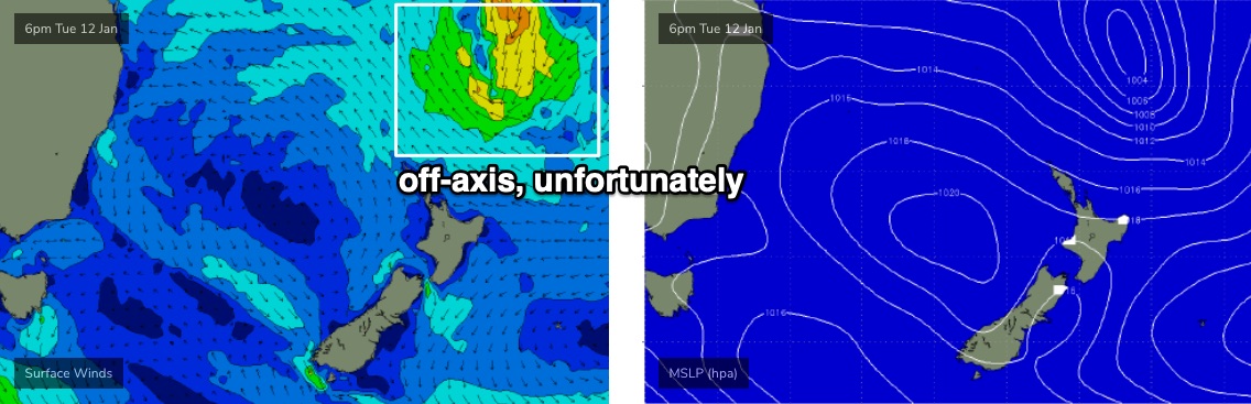
Elsewhere, and a broad ridge through the Northern Tasman Sea all week will generate small sideband trade swells in the 2ft+ range. A more significant trough developing at the tail end of this ridge (see below) currently doesn’t look like it’ll align favourably within our swell window, but I’ll keep a close eye on this over the coming days, as it is modeled to deepen nicely - unfortunately after passing behind the NZ swell shadow.
Otherwise, there’s a suggestion for a more significant local feature to develop within a broad trough developing across the south-western Tasman Sea later next week and weekend, which could bring about some more sizeable surf through into the start of the following week.
More on that in Monday’s update. Have a great weekend!