Building southerly swell tomorrow with onshore winds, easing Wednesday and cleaner. Similar Friday, with cleaner easing surf Saturday.
Primary tabs
/reports/forecaster-notes/eastern-tasmania/2017/06/05/small-weak-southerly-windswells
Craig
Monday, 5 June 2017
/reports/forecaster-notes/eastern-tasmania/2017/05/26/average-period-no-major-swells
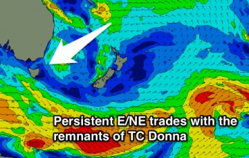
Craig
Friday, 26 May 2017
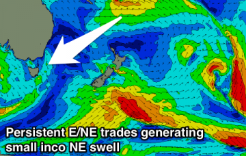
Very inconsistent NE swell tomorrow with less than ideal winds, cleaner and fading Sunday. No major surf next week.

/reports/forecaster-notes/eastern-tasmania/2017/05/24/small-flukey-and-inconsistent-ne-swell
Craig
Wednesday, 24 May 2017
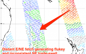
Nothing significant with a very inconsistent NE swell for the weekend.
/reports/forecaster-notes/eastern-tasmania/2017/05/22/easing-sse-groundswell-smaller-thereafter
Craig
Monday, 22 May 2017
Easing S/SE groundswell and new NE swell for the afternoon, then smaller NE trade-swell to follow.
/reports/forecaster-notes/eastern-tasmania/2017/05/19/great-waves-sunday-mix-swells
Craig
Friday, 19 May 2017
Onshore building NE swell tomorrow, clean and easing out of the E/NE Sunday with a new S/SE groundswell for the afternoon. Great waves Monday, smaller Tuesday.
/reports/forecaster-notes/eastern-tasmania/2017/05/17/great-forecast-period-swells-all-directions
Craig
Wednesday, 17 May 2017
Clean easing E'ly swell tomorrow, with a good S'ly groundswell for Friday, spoilt by onshore winds. Solid improving and easing NE swell Sunday with a SE groundswell for the afternoon, peaking Monday morning.
/reports/forecaster-notes/eastern-tasmania/2017/05/15/dynamic-week-lots-surf
Craig
Monday, 15 May 2017
Building SE swell tomorrow with a better E/NE groundswell Wednesday and then S'ly swell Friday.
/reports/forecaster-notes/eastern-tasmania/2017/05/12/flukey-north-east-trade-swell-more-potential
Craig
Friday, 12 May 2017
Small inconsistent and flukey NE swell tomorrow, followed by weak S/SE windswell from later Sunday. Better swell potential from the NE mid-week.
/reports/forecaster-notes/eastern-tasmania/2017/05/10/fun-ne-trade-swell-weekend
Craig
Wednesday, 10 May 2017
Tiny tomorrow and most of Friday, with a fun but inconsistent NE trade-swell for Saturday. Possible better swell developments later next week.
/reports/forecaster-notes/eastern-tasmania/2017/05/08/easing-sse-swell-ne-swell-weekend
Craig
Monday, 8 May 2017
Easing S'ly and S/SE swells tomorrow, smaller but cleaner Wednesday. Fun but inconsistent NE swell for Saturday.