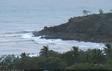
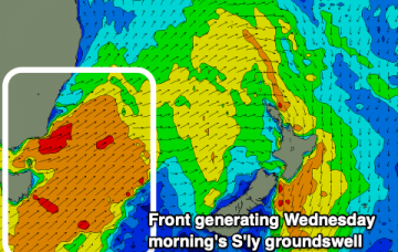
And…. that’s the last significant east swell we are going to see for a while. But there's a lengthy spell of sizeable south swells on the way. More in the Forecaster Notes.
Primary tabs
/reports/forecaster-notes/south-east-queensland-northern-new-south-wales/2019/07/29/end-easterly-era
thermalben
Monday, 29 July 2019
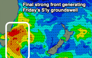
/reports/forecaster-notes/south-east-queensland-northern-new-south-wales/2019/07/26/plenty-swell
thermalben
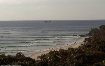
Friday, 26 July 2019
So, without labouring the point, expectations are still that locations further north will see the most size. More in the Forecaster Notes.
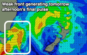
/reports/forecaster-notes/south-east-queensland-northern-new-south-wales/2019/07/24/sustained-though
thermalben
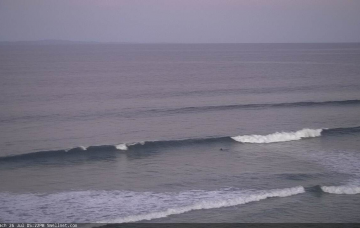
Wednesday, 24 July 2019
Confidence is not high for this event. All we can really do is highlight the expect trend, peg a size and a region for the upper limits, and then see what happens. More in the Forecaster Notes.
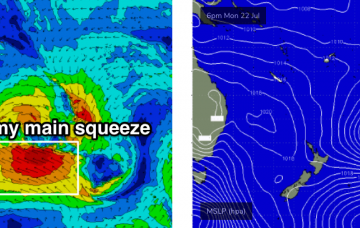
/reports/forecaster-notes/south-east-queensland-northern-new-south-wales/2019/07/22/think-charts-look
thermalben
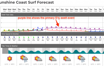
Monday, 22 July 2019
There's some really interesting features on the synoptic charts, and some regions may pick up solid swell over the coming week. More in the Forecaster Notes.
/reports/forecaster-notes/south-east-queensland-northern-new-south-wales/2019/07/19/make-most-weekend
Craig
Friday, 19 July 2019
Easing and clean S'ly swells with nothing of significance to follow.
/reports/forecaster-notes/south-east-queensland-northern-new-south-wales/2019/07/17/southerly-swells
Craig
Wednesday, 17 July 2019
A couple more pulses of southerly swell with generally favourable winds, fading away from Sunday.
/reports/forecaster-notes/south-east-queensland-northern-new-south-wales/2019/07/15/steady-diet
Craig
Monday, 15 July 2019
Plenty of southerly swell this week with generally favourable winds each morning.
/reports/forecaster-notes/south-east-queensland-northern-new-south-wales/2019/07/12/southerly-swells
thermalben
Friday, 12 July 2019
Hope you’ve enjoyed the last fortnight’s unseasonably good run of extended E’ly swell. Because this swell window has shut down for the foreseeable future, and we’ll be reliant on southerly swell for the next couple of weeks. More in the Forecaster Notes.
/reports/forecaster-notes/south-east-queensland-northern-new-south-wales/2019/07/10/slow-decline
thermalben
Wednesday, 10 July 2019
The swell and wind outlook for next week looks promising at first glance - but I see a lot of potential for disappointment across vast swathes of SE Qld and Northern NSW, because of the size and direction. More in the Forecaster Notes.
/reports/forecaster-notes/south-east-queensland-northern-new-south-wales/2019/07/08/return-typical
thermalben
Monday, 8 July 2019
Punchy options at open stretches will trend smaller throughout the week, but offer fun clean waves through into the weekend. More in the Forecaster Notes.