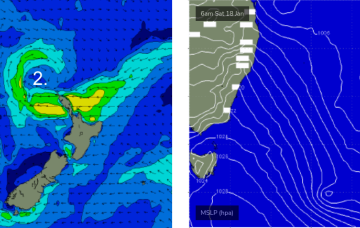
A final low pressure system associated with our recent complex synoptic pattern moved from a position north of New Zealand last week, into the Tasman Sea over the weekend.
Primary tabs
/reports/forecaster-notes/sydney-hunter-illawarra/2025/01/20/punchy-east-swell-the-next-few-days-then
thermalben
Monday, 20 January 2025

/reports/forecaster-notes/sydney-hunter-illawarra/2025/01/17/flag-the-weekend-early-next-week-looking
thermalben
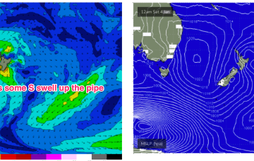
Friday, 17 January 2025
The Tasman Sea currently has a number of low pressure centers, driving strong winds from a couple of directions across various parts of the basin.

/reports/forecaster-notes/sydney-hunter-illawarra/2025/01/15/stacks-swell-and-wind-the-short-term
thermalben
Wednesday, 15 January 2025
A few changes to the outlook for the weekend, but in general I’m still anticipating better surf early next week.
/reports/forecaster-notes/sydney-hunter-illawarra/2025/01/13/large-swells-ahead-complex-tasman-low
thermalben
Monday, 13 January 2025
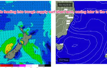
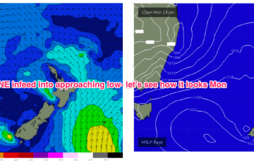
Main features on the synoptics this week are an approaching front from the west, a strong high just west of New Zealand and a deepening surface trough in the northern Tasman Sea - the latter of which will feed additional moisture into an already-evolving dynamic setup.

/reports/forecaster-notes/sydney-hunter-illawarra/2025/01/10/small-and-surfable-short-term-dynamic
freeride76
Friday, 10 January 2025
GFS suggests the inland trough moves Northwards, with a trough spawning a small low east of Tasmania and rapidly deepens o/night into Fri with strong winds to gales developing off the south coast and Bass Strait.

/reports/forecaster-notes/sydney-hunter-illawarra/2025/01/07/make-the-most-whats-offer-in-the-short
freeride76
Wednesday, 8 January 2025
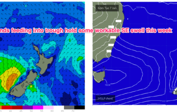
A small trough of low pressure has stalled off Seal Rocks with a SE infeed south of the trough expected to ease over the next 24 hrs and a light/variable flow north of the trough.
/reports/forecaster-notes/sydney-hunter-illawarra/2025/01/05/workable-weak-the-first-significant
freeride76
Monday, 6 January 2025
The current synoptic situation has a Groundhog Day feel to it, with another very weak high pressure cell in the Tasman (1019hPa), directing a mod N’ly flow along the temperate NSW coastline, with a weak Tradewind flow in the Coral Sea
/reports/forecaster-notes/sydney-hunter-illawarra/2025/01/02/small-waves-the-weekend-starting-see
freeride76
Friday, 3 January 2025
Further ahead and we have a dynamic outlook on the cards. An inland low and trough - a hybrid monsoonal feature- looks to approach the NSW coast, with a strengthening NE infeed into the system.
/reports/forecaster-notes/sydney-hunter-illawarra/2024/12/31/ne-windswells-ahead-flukey-s-swell-in
freeride76
Wednesday, 1 January 2025
Sun looks like more energy, especially south of Sydney, as NE windswell builds in response to a strengthening N/NE flow as high pressure and an approaching trough combine.
/reports/forecaster-notes/sydney-hunter-illawarra/2024/12/30/very-quiet-outlook-minor-windswells
freeride76
Monday, 30 December 2024
Very weak pressure gradients in the Tasman and Coral Seas as we count down 2024.
