Great over the coming days

Victorian Surf Forecast by Craig Brokensha (issued Monday 29th May)
Best Days: Today, tomorrow, Wednesday, Friday, Saturday morning
Features of the Forecast (tl;dr)
- Moderate sized + mix of SW swells easing tomorrow with gusty W/NW-NW winds
- Smaller Wed with strong NW tending N/NW winds
- Strong but easing SW winds on Thu, tending S'ly later (likely W/NW early Surf Coast)
- Small early Thu, with a large swell building later
- Easing large swell Fri with N-N/NE tending E/NE-NE winds
- Easing surf Sat with N/NW tending S/SW winds
- Poor Sun with strong E/SE winds
Recap
What a weekend of surf! Saturday provided a warm up with clean conditions and surf in the 4ft range across the Surf Coast, building into the afternoon ahead of a larger pulse of SW groundswell yesterday morning. Early it was in the 6ft range with excellent conditions, building steadily through the day as a larger, longer-period swell arrived. Pumping 8-10ft surf was seen under pristine conditions, one of the best days of surf on the coast for a few years.
This morning conditions are still excellent with an easing SW groundswell from 6-8ft on the Surf Coast with a moderate to fresh offshore wind. Winds will hold out of the W/NW all day as the swell continues to ease.
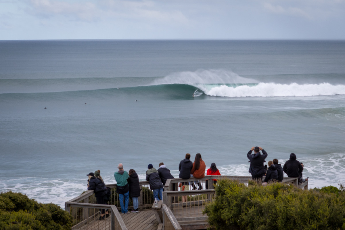
Large perfection yesterday (Steve Arklay)
This week and weekend (May 30 – Jun 4)
Following an epic weekend of surf and excellent start to the week, tomorrow will continue to provide quality surf with a further drop in size under gusty W/NW-NW winds. A cold front pushing through today will slow the easing trend, bringing a reinforcing pulse of mid-period SW swell.
Easing 4-5ft sets are due on the Surf Coast magnets 6ft to possibly 8ft to the east, smaller Wednesday and easing back from 3ft and 4-5ft respectively.
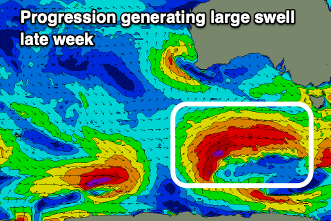
Strong NW tending N/NW winds will open up plenty of options Wednesday, while a strong SW change will move through before dawn Thursday, easing steadily in strength through the day. There's a good chance of an early W/NW'ly on the Surf Coast and size wise, this frontal system will generate a large sized pulse of SW groundswell for later in the day, that will ease Friday.
The front will develop south-southwest of Western Australia today but be patchy, strengthening and becoming more consolidated tomorrow evening and Wednesday, generating a great fetch of gale to severe-gale W/SW winds while projecting north-east towards us.
Building surf back to the 6ft range is due on the Surf Coast into the afternoon Thursday with weak S'ly winds, 8ft+ to the east, then easing back from 5-6ft and 6-8ft Friday morning.
Winds will be light out of the N tending N/NE on the Surf Coast Friday morning, N/NE to the east, shifting more E/NE-NE through the afternoon.
Saturday will become smaller with N/NW winds ahead of a trough and S/SW change, poor into Sunday as winds strengthen from the E/SE as the trough possibly forms into a low to our east.
Longer term it looks like well enter a period of funky swells and winds with mid-latitude activity, so make the most of the current surf and days ahead.
Comments
Today was good for surfing at W.P. . :-) .
There is some excellent footage of Bells and Winki on You Tube, under 'Effortless Surf the morning of 28th' if anyone is interested. The surf report could have given 9 or 10, not just 8 yesterday by the look of it I reckon.
I thought the same. Wondering what it takes to get a 9 or 10 if the weekend wasn’t it!
FYI you can copy and paste the youtube URL into a comment and it will automatically embed...