Wintery blast on the way
Wednesday, 27 November 2019
Wintery blast on the way
Wednesday, 27 November 2019
Mostly average but workable end to the week ahead of a wintery blast of wind and swell into next week.
Mostly average but workable end to the week ahead of a wintery blast of wind and swell into next week.
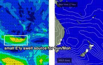
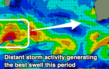
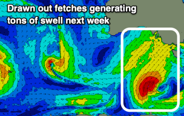
The S’ly change will be the dominant feature on Wednesday, but it’s worth mentioning that we may see a small E’ly swell in the water across SE Qld, from a low that spun up just NE of New Zealand over the weekend. More in the Forecaster Notes.
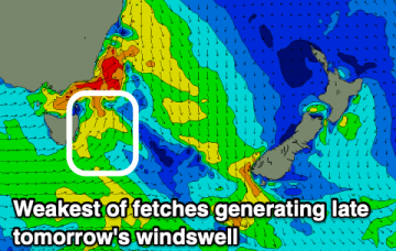
Tiny waves besides a fun W/SW swell through this week, plenty of activity next week.
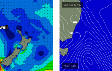
A vigorous cold front will push up the Southern NSW coast on Tuesday, reaching Wollongong late afternoon and Sydney after sunset. More in the Forecaster Notes.
Make the most of tomorrow and then hold tight until next week.
Not the best surf outlook, mainly owing to local winds rather than lack of swell.
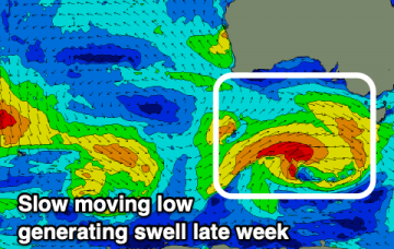
Not the best week of surf, so make the most of today, with plenty of wind and swell on the cards from later in the weekend.
Northerly winds will remain the dominant feature for the next four days. More in the Forecaster Notes.
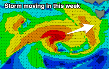
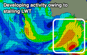
The storm track is all out of whack for our swell window right now. It's all pretty forgettable stuff, to be honest. More in the Forecaster Notes.