Coupla fun days ahead, then stormy haunts to get a thorough workout
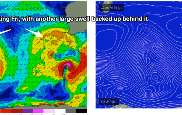
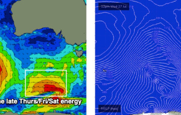
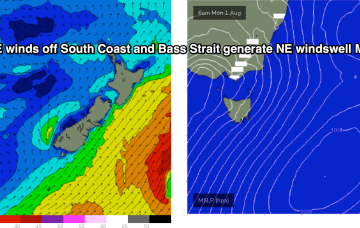
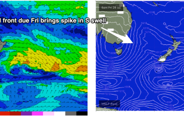
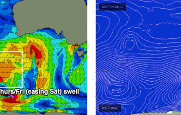
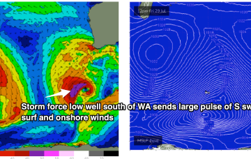
We’ve got some new swell inbound over the next few days, and conditions are looking pretty good too.
Very active Indian Ocean storm track continues with fronts and deep lows forming near Heard Island before being steered NE towards WA as decaying fronts. That's seeing multiple large swell events over the f/cast period.
More swell is due over the coming days however conditions are looking pretty ordinary, thanks to the passage of two fronts - one tonight and the other Thursday night.
We are now close to the end game as the low which started off the CQ Coast in the Coral Sea expends it’s last energy off the bottom of the South Island New Zealand, with a fetch still well aimed for East Coast Tasmania.
One of the features of this current La Niña phase has been long-lived swell events as low pressure lingers in the Tasman Sea. This current event is typical of that pattern. We are now close to the end game as the low which started off the CQ Coast in the Coral Sea expends it’s last energy off the bottom of the South Island New Zealand.
Thursday’s actually got some potential.
We’ve got some new swell on the way for tomorrow though conditions are going to become quite blustery with westerly gales thanks to the passage of a cold front.
That front is tied to another deep low, driving a large area of seas between 20-30ft towards WA. Proximity equals size with another extended period of large to XL wave heights expected to build in Fri
Current ASCAT (satellite windspeed) pass shows storm force winds embedded in a larger fetch of SE-ESE gales to severe gales aimed back at the Eastern Seaboard including Tasmania.