West swells and north-west winds
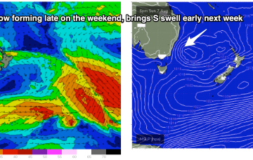
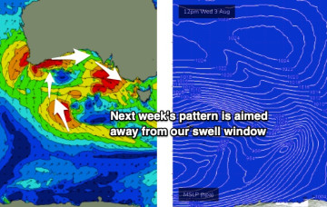
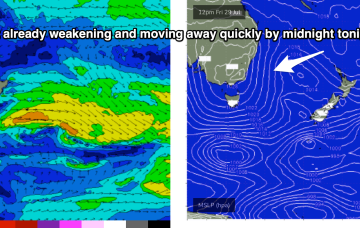
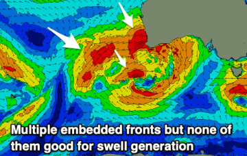
Plenty of westerly swell later this week but with average winds for the Mid Coast. It'll be too west for the South Coast, but there's a fun S'ly swell due Saturday.
We’ve finally come to a low spot in the current La Niña phase we are in with energy being dialled right back this week. The high pressure belt is moving at a more typical northerly latitude over interior Australia and with weaker, more mobile high pressure moving over the interior and into the Tasman, we are looking at a period of N’ly biased winds with W’ly oriented fronts being quickly shunted across the Tasman.
The outlook remains very sub-par with no decent swell generating systems due over the coming week at least.
Tues and Wed will be a write-off except for the most sheltered winter Bays as a monster storm slams into WA
In essence, the storm track is aimed pretty much everywhere except for the Vicco and Southern Tasmanian swell windows.
High pressure rapidly moves off the NSW Coast early next week, driving a N’ly flow off the South Coast into Bass Strait. Unfortunately, this fetch is now disjointed and rapidly shifts to the NW through Mon.
The long term outlook remains unchanged for Victorian surfers. You’re not gonna be happy.
A much quieter period ahead as weak, spring-like conditions establish from Monday.
No great action on the radar after this weekend as spring-like N'ly pattern establishes.