Poor weekend, strong swell next week
Friday, 8 December 2023
Poor weekend, strong swell next week
Friday, 8 December 2023
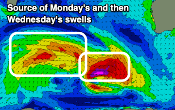
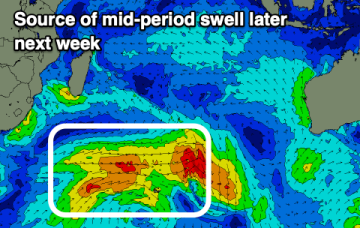
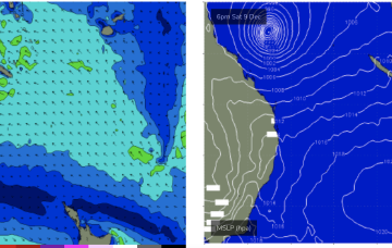
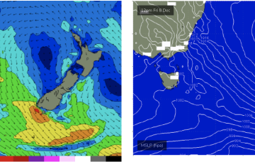
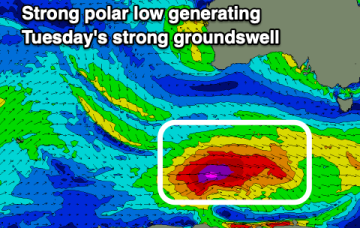
Strong onshore winds will move in tomorrow, with a weak windswell for Sunday. A large, strong groundswell is due next week.