Cyclone in the Coral Sea now likely with large swells expected under a southwards track
Monday, 4 December 2023

Cyclone in the Coral Sea now likely with large swells expected under a southwards track
Monday, 4 December 2023
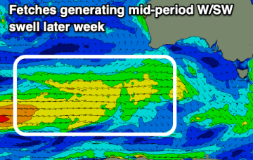
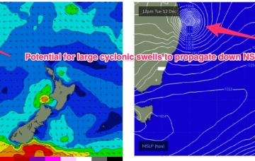
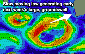
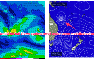
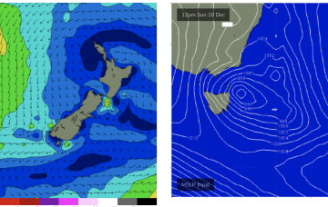
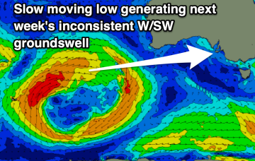
Weak high pressure in the Tasman and a trough is creating a “doldrums” type pattern of slack pressure gradients and small swells this week, with a few wind changes to negotiate. No major swells expected this week. The headline feature is a potential major tropical cyclone drifting into the Coral Sea with a poleward (southwards) track late this week, over the weekend and into next week.