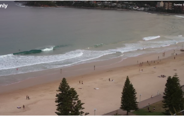
Tiny ahead of a large, but onshore swell
Monday, 2 October 2023
Tiny ahead of a large, but onshore swell
Monday, 2 October 2023
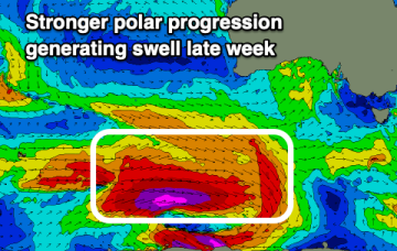
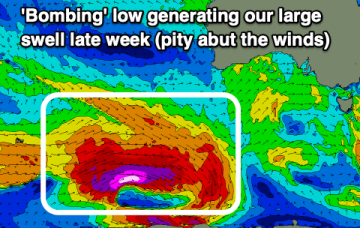
Winds look to spoil both the building and easing trend of a large groundswell due late week.
Winds look to spoil both the building and easing trend of a large groundswell due late week.
It's one of the strongest N'ly local fetches we've seen in a while and will consequently deliver a punchy, sizeable NE windswell during the middle of the week.
XL surf for this afternoon and early tomorrow as conditions slowly improve, best later week in the South West.
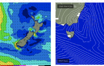
Main feature on the synoptic charts is a strengthening N'ly fetch adjacent the NSW coast, between a Tasman high and an approaching front through the Bight.
The coming west swell for the Mid will be onshore, while the large south swell for the South Coast looks to follow a similar trend.
The coming period isn't great with troughy weather and onshore winds due to wreck a couple of great swells.
Mon should be the low point, possibly running into Tues before we see a modest rebuild in new E’ly tradewind swell as tradewinds reestablish across the South and Eastern Coral Seas.
Into the new week and it still looks dynamic with several strong N’ly fetches.
Make the most of tomorrow's waves before tiny surf develops. Late next week looks large but onshore.
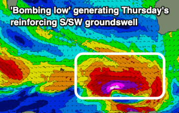
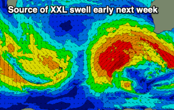
We've got a poor few days of surf with an XL swell for early next week, improving while easing into the rest of the week. A reinforcing large S/SW groundswell is also due late week.