Fun W/SW swell with favourable winds
Wednesday, 10 January 2024
Fun W/SW swell with favourable winds
Wednesday, 10 January 2024
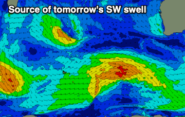
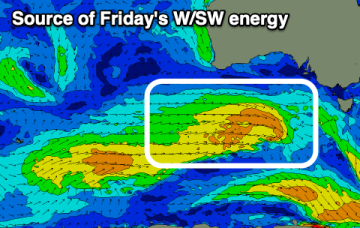
The coming days look fun with a mix of W/SW swells and favourable morning winds.
The coming days look fun with a mix of W/SW swells and favourable morning winds.
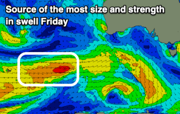
There's a good mix of W/SW swells due into the end of the week with workable winds. The weekend will be poor.
Make the most of the coming swells, with west-northwest monsoon winds kicking in across Indonesia over the period.
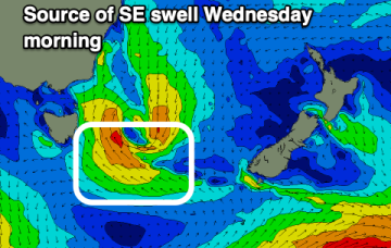
Average tomorrow, better Wednesday with a fun, easing SE swell.
Easterly swells will favour the sub-tropics for size with the CQ region seeing small swells later this week as the fetch is on the edge of the swell window. Longer term is starting to look very active as well.
Winds will be less than ideal and with strength most of this week along with some fun swell.
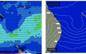
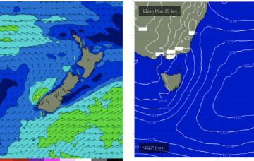
The low east of Tasmania supplies plenty of strong S-SE swell through the short term with an easing trend back to small background swells this week.
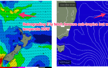
Once the Tasmania low clears there picture we’ll see monsoonal activity develop through the South Pacific/Coral Sea, likely with a broad area of low pressure squeezing pressure gradients along a long fetch between the North Island and near Island chains and retrograding back towards the East coast through the second half of this week.
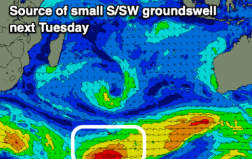
The coming days will be small ahead of some new W/SW swell later week with favourable winds.
Troughy weather and flukey winds will create tricky conditions for surfing. Late week looks best ahead of a stormy SE windswell.